


a-drenthe-rondje-westerveld

gpstracks
Utilisateur
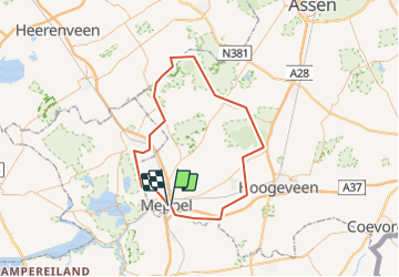

Longueur
83 km

Altitude max
25 m

Dénivelé positif
428 m
Km-Effort
88 km

Altitude min
-4 m

Dénivelé négatif
427 m
Boucle
Non
Date de création :
2014-12-10 00:00:00.0
Dernière modification :
2014-12-10 00:00:00.0
--
Difficulté : Inconnu

Application GPS de randonnée GRATUITE
 SityTrail
IGN / Instituts géographiques
SityTrail Plus
Le monde est à vous
À propos
Randonnée Moteur de 83 km à découvrir à Drenthe, Inconnu, Meppel. Cette randonnée est proposée par gpstracks.
Description
More information on GPStracks.nl : http://www.gpstracks.nl


Localisation
Pays :
Pays-Bas
Région :
Drenthe
Département/Province :
Inconnu
Commune :
Meppel
Localité :
Unknown
Départ:(Dec)
Départ:(UTM)
311463 ; 5841733 (32U) N.
Commentaires