![](/images/other/stat-length.png)
![Randonnée Marche Tende - 2021-07-01 Sortie CAF - Mercantour J2 - Photo](https://media.geolcdn.com/t/1900/400/ext.pjpeg?maxdim=2&url=https%3A%2F%2Fstatic1.geolcdn.com%2Fsiteimages%2Fupload%2Ffiles%2F1553511878bg_sport_marche.png)
2021-07-01 Sortie CAF - Mercantour J2
eric.mignot
Utilisateur
![Longueur](/images/other/stat-length.png)
Longueur
17,5 km
![Altitude max](https://static1.geolcdn.com/siteimages/upload/files/1508320355ic_sort_altitude_max_24dp.png)
Altitude max
2328 m
![Dénivelé positif](https://static1.geolcdn.com/siteimages/upload/files/1508320355ic_sort_den_pos_24dp.png)
Dénivelé positif
920 m
![Km-Effort](/images/other/stat-length.png)
Km-Effort
30 km
![Altitude min](https://static1.geolcdn.com/siteimages/upload/files/1508320355ic_sort_altitude_min_24dp.png)
Altitude min
1840 m
![Dénivelé négatif](https://static1.geolcdn.com/siteimages/upload/files/1508320355ic_sort_den_neg_24dp.png)
Dénivelé négatif
921 m
![Boucle](https://static1.geolcdn.com/siteimages/upload/files/16400158638029165_repeat_loop_refresh_sync_direction_icon.png)
Boucle
Oui
Date de création :
2021-07-01 05:43:57.541
Dernière modification :
2021-07-08 16:55:41.741
![Marche](https://static1.geolcdn.com/sitytour/trail-icons/101.png)
7h00
Difficulté : Moyen
![Scannez ce code QR pour ouvrir la randonnée dans l'application SityTrail](https://capi.geolives.com/qq0zvz2zws4bq2lad0pu/sitytour/trails/2852419/qr.png?size=200)
Application GPS de randonnée GRATUITE
À propos
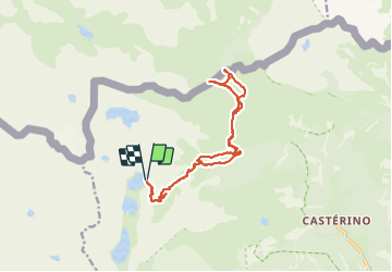
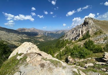
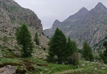
Randonnée Marche de 17,5 km à découvrir à Provence-Alpes-Côte d'Azur, Alpes-Maritimes, Tende. Cette randonnée est proposée par eric.mignot.
Description
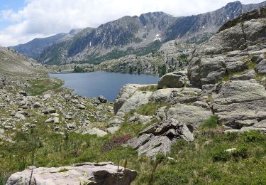
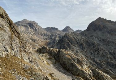
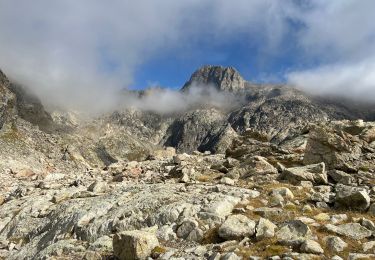
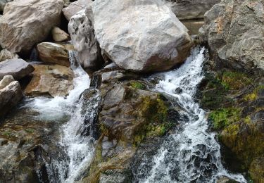
le col ouest du Sabion (2327m) au dessus du Lago de lla Vacca
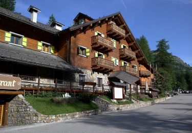
depuis le refuge de Valmasque (2233m)
par le vallon de Valmasque puis celui du Sabion
Localisation
Pays :
France
Région :
Provence-Alpes-Côte d'Azur
Département/Province :
Alpes-Maritimes
Commune :
Tende
Localité :
Unknown
Départ:(Dec)
Départ:(UTM)
375701 ; 4885058 (32T) N.
Commentaires
Randonnées à proximité
![Randonnée A pied Tende - Circuit de Fontanalbe - Photo](https://media.geolcdn.com/t/375/260/ext.jpg?maxdim=2&url=https%3A%2F%2Fmedia.geolcdn.com%2Ff%2Ffbada9bc-eac2-4c15-a16e-af4bb85123b6.jpeg)
![A pied A pied](https://static1.geolcdn.com/sitytour/trail-icons/100.png)
Circuit de Fontanalbe
A pied
Moyen
Tende,
Provence-Alpes-Côte d'Azur,
Alpes-Maritimes,
France
![](/images/other/stat-length.png)
14,6 km | 24 km-effort
5h 28min
![](https://static1.geolcdn.com/siteimages/upload/files/16400158638029165_repeat_loop_refresh_sync_direction_icon.png)
Oui
![Randonnée A pied Belvédère - Les Merveilles par la Gordolasque - Photo](https://media.geolcdn.com/t/375/260/ext.jpg?maxdim=2&url=https%3A%2F%2Fmedia.geolcdn.com%2Ff%2F530d04a7-b615-4962-acf5-9f79fcad8eda.jpeg)
![A pied A pied](https://static1.geolcdn.com/sitytour/trail-icons/100.png)
Les Merveilles par la Gordolasque
A pied
Moyen
Belvédère,
Provence-Alpes-Côte d'Azur,
Alpes-Maritimes,
France
![](/images/other/stat-length.png)
13 km | 29 km-effort
6h 35min
![](https://static1.geolcdn.com/siteimages/upload/files/16400158638029165_repeat_loop_refresh_sync_direction_icon.png)
Oui
![Randonnée Marche Tende - Valmasque- Bego-Pas de L'Autier-Countet - Photo](https://media.geolcdn.com/t/375/260/ext.jpg?maxdim=2&url=https%3A%2F%2Fstatic1.geolcdn.com%2Fsiteimages%2Fupload%2Ffiles%2F1553511878bg_sport_marche.png)
![Marche Marche](https://static1.geolcdn.com/sitytour/trail-icons/101.png)
Valmasque- Bego-Pas de L'Autier-Countet
Marche
Difficile
(1)
Tende,
Provence-Alpes-Côte d'Azur,
Alpes-Maritimes,
France
![](/images/other/stat-length.png)
16,9 km | 30 km-effort
5h 57min
![](https://static1.geolcdn.com/siteimages/upload/files/16400158638029165_repeat_loop_refresh_sync_direction_icon.png)
Non
![Randonnée Marche Belvédère - Tête du Lac Autier - Photo](https://media.geolcdn.com/t/375/260/ext.jpg?maxdim=2&url=https%3A%2F%2Fmedia.geolcdn.com%2Ff%2F9d70df2e-e215-4331-b875-77b866dcb7bf.jpg)
![Marche Marche](https://static1.geolcdn.com/sitytour/trail-icons/101.png)
Tête du Lac Autier
Marche
Très difficile
Belvédère,
Provence-Alpes-Côte d'Azur,
Alpes-Maritimes,
France
![](/images/other/stat-length.png)
9,9 km | 24 km-effort
5h 54min
![](https://static1.geolcdn.com/siteimages/upload/files/16400158638029165_repeat_loop_refresh_sync_direction_icon.png)
Oui
![Randonnée Marche Tende - Boucle à Fontanalba - Photo](https://media.geolcdn.com/t/375/260/ext.jpg?maxdim=2&url=https%3A%2F%2Fmedia.geolcdn.com%2Ff%2F5a02cdc0-abff-43e4-9137-5fe1682e5e68.jpg)
![Marche Marche](https://static1.geolcdn.com/sitytour/trail-icons/101.png)
Boucle à Fontanalba
Marche
Moyen
Tende,
Provence-Alpes-Côte d'Azur,
Alpes-Maritimes,
France
![](/images/other/stat-length.png)
12,8 km | 24 km-effort
4h 57min
![](https://static1.geolcdn.com/siteimages/upload/files/16400158638029165_repeat_loop_refresh_sync_direction_icon.png)
Non
![Randonnée Marche Belvédère - randonnée du Mercantour le 09 juin 2023 - Photo](https://media.geolcdn.com/t/375/260/ext.jpg?maxdim=2&url=https%3A%2F%2Fmedia.geolcdn.com%2Ff%2Fb754a250-2219-48b3-9477-eca56cfecf75.jpg)
![Marche Marche](https://static1.geolcdn.com/sitytour/trail-icons/101.png)
randonnée du Mercantour le 09 juin 2023
Marche
Moyen
Belvédère,
Provence-Alpes-Côte d'Azur,
Alpes-Maritimes,
France
![](/images/other/stat-length.png)
4,1 km | 6,5 km-effort
1h 58min
![](https://static1.geolcdn.com/siteimages/upload/files/16400158638029165_repeat_loop_refresh_sync_direction_icon.png)
Oui
![Randonnée Marche Belvédère - Mont Colomb - Photo](https://media.geolcdn.com/t/375/260/ext.jpg?maxdim=2&url=https%3A%2F%2Fmedia.geolcdn.com%2Ff%2F221e8a9d-00f9-4399-81ae-78f4e77f3f4a.jpg)
![Marche Marche](https://static1.geolcdn.com/sitytour/trail-icons/101.png)
Mont Colomb
Marche
Très difficile
Belvédère,
Provence-Alpes-Côte d'Azur,
Alpes-Maritimes,
France
![](/images/other/stat-length.png)
13 km | 29 km-effort
6h 10min
![](https://static1.geolcdn.com/siteimages/upload/files/16400158638029165_repeat_loop_refresh_sync_direction_icon.png)
Non
![Randonnée Marche Belvédère - La Maleidié - Photo](https://media.geolcdn.com/t/375/260/ext.jpg?maxdim=2&url=https%3A%2F%2Fmedia.geolcdn.com%2Ff%2F1cc6b095-f297-45ed-9aab-21c0ab3a419d.jpg)
![Marche Marche](https://static1.geolcdn.com/sitytour/trail-icons/101.png)
La Maleidié
Marche
Très difficile
Belvédère,
Provence-Alpes-Côte d'Azur,
Alpes-Maritimes,
France
![](/images/other/stat-length.png)
16,8 km | 35 km-effort
8h 40min
![](https://static1.geolcdn.com/siteimages/upload/files/16400158638029165_repeat_loop_refresh_sync_direction_icon.png)
Oui
![Randonnée Marche Tende - 83 fontanalba lac des mesches - Photo](https://media.geolcdn.com/t/375/260/ext.jpg?maxdim=2&url=https%3A%2F%2Fmedia.geolcdn.com%2Ff%2Fb97ea35d-6453-4d46-a2d9-b51ae651ac2f.jpg)
![Marche Marche](https://static1.geolcdn.com/sitytour/trail-icons/101.png)
83 fontanalba lac des mesches
Marche
Moyen
Tende,
Provence-Alpes-Côte d'Azur,
Alpes-Maritimes,
France
![](/images/other/stat-length.png)
11,6 km | 19,6 km-effort
5h 19min
![](https://static1.geolcdn.com/siteimages/upload/files/16400158638029165_repeat_loop_refresh_sync_direction_icon.png)
Non