


02-Lucelle-Abbaye Cistercienne

geranimo
Utilisateur
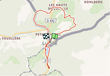

Longueur
9,2 km

Altitude max
748 m

Dénivelé positif
260 m
Km-Effort
12,6 km

Altitude min
594 m

Dénivelé négatif
259 m
Boucle
Oui
Date de création :
2021-07-18 20:59:19.483
Dernière modification :
2021-07-25 22:31:13.087
2m
Difficulté : Moyen

Application GPS de randonnée GRATUITE
 SityTrail
IGN / Instituts géographiques
SityTrail Plus
Le monde est à vous
À propos
Randonnée Marche de 9,2 km à découvrir à Grand Est, Haut-Rhin, Lucelle. Cette randonnée est proposée par geranimo.
Localisation
Pays :
France
Région :
Grand Est
Département/Province :
Haut-Rhin
Commune :
Lucelle
Localité :
Unknown
Départ:(Dec)
Départ:(UTM)
367776 ; 5253500 (32T) N.
Commentaires