


Ranpont

lucmarescot
Utilisateur
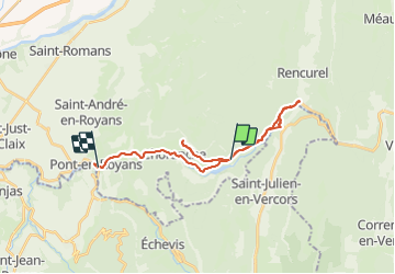

Longueur
24 km

Altitude max
885 m

Dénivelé positif
854 m
Km-Effort
37 km

Altitude min
198 m

Dénivelé négatif
1128 m
Boucle
Non
Date de création :
2021-09-13 14:00:32.0
Dernière modification :
2021-09-13 15:53:21.684
1h52
Difficulté : Inconnu

Application GPS de randonnée GRATUITE
 SityTrail
IGN / Instituts géographiques
SityTrail Plus
Le monde est à vous
À propos
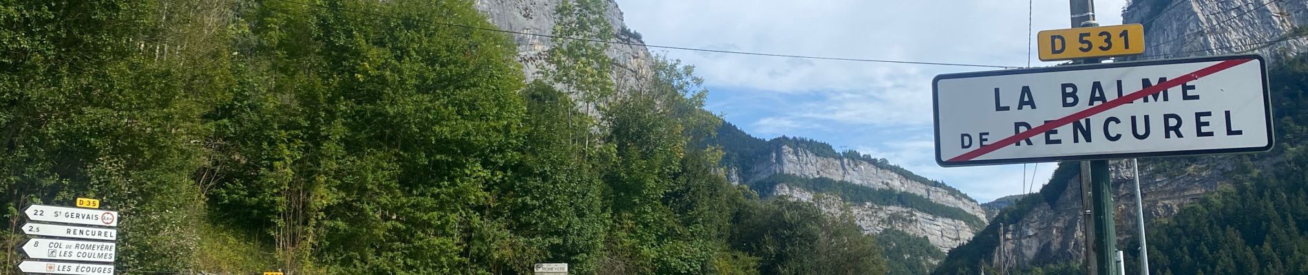
Randonnée V.T.T. de 24 km à découvrir à Auvergne-Rhône-Alpes, Isère, Choranche. Cette randonnée est proposée par lucmarescot.
Photos

Localisation
Pays :
France
Région :
Auvergne-Rhône-Alpes
Département/Province :
Isère
Commune :
Choranche
Localité :
Unknown
Départ:(Dec)
Départ:(UTM)
691086 ; 4992962 (31T) N.
Commentaires