


Sennely nord

lemuid
Utilisateur
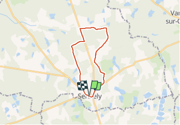

Longueur
10,3 km

Altitude max
140 m

Dénivelé positif
74 m
Km-Effort
11,2 km

Altitude min
116 m

Dénivelé négatif
73 m
Boucle
Oui
Date de création :
2021-11-12 08:19:02.721
Dernière modification :
2021-11-21 10:09:34.203
1h53
Difficulté : Facile

Application GPS de randonnée GRATUITE
 SityTrail
IGN / Instituts géographiques
SityTrail Plus
Le monde est à vous
À propos
Randonnée Marche de 10,3 km à découvrir à Centre-Val de Loire, Loiret, Sennely. Cette randonnée est proposée par lemuid.
Localisation
Pays :
France
Région :
Centre-Val de Loire
Département/Province :
Loiret
Commune :
Sennely
Localité :
Unknown
Départ:(Dec)
Départ:(UTM)
435921 ; 5280813 (31T) N.
Commentaires