![](/images/other/stat-length.png)
![Randonnée A pied Bierbeek - Sint-Ermelindiswandelpad - Photo](https://media.geolcdn.com/t/1900/400/ext.pjpeg?maxdim=2&url=https%3A%2F%2Fmedia.geolcdn.com%2Ff%2F9625783c-6ca5-421c-8aa7-79681cc715da.jpeg)
Sint-Ermelindiswandelpad
SityTrail - itinéraires balisés pédestres
Tous les sentiers balisés d’Europe PRO
![Longueur](/images/other/stat-length.png)
Longueur
7,6 km
![Altitude max](https://static1.geolcdn.com/siteimages/upload/files/1508320355ic_sort_altitude_max_24dp.png)
Altitude max
76 m
![Dénivelé positif](https://static1.geolcdn.com/siteimages/upload/files/1508320355ic_sort_den_pos_24dp.png)
Dénivelé positif
68 m
![Km-Effort](/images/other/stat-length.png)
Km-Effort
8,5 km
![Altitude min](https://static1.geolcdn.com/siteimages/upload/files/1508320355ic_sort_altitude_min_24dp.png)
Altitude min
46 m
![Dénivelé négatif](https://static1.geolcdn.com/siteimages/upload/files/1508320355ic_sort_den_neg_24dp.png)
Dénivelé négatif
69 m
![Boucle](https://static1.geolcdn.com/siteimages/upload/files/16400158638029165_repeat_loop_refresh_sync_direction_icon.png)
Boucle
Oui
Balise
Date de création :
2022-02-09 14:24:27.896
Dernière modification :
2022-03-10 09:15:20.715
![A pied](https://static1.geolcdn.com/sitytour/trail-icons/100.png)
1h55
Difficulté : Facile
![Scannez ce code QR pour ouvrir la randonnée dans l'application SityTrail](https://capi.geolives.com/qq0zvz2zws4bq2lad0pu/sitytour/trails/3083134/qr.png?size=200)
Application GPS de randonnée GRATUITE
À propos
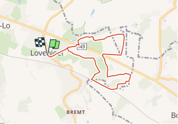
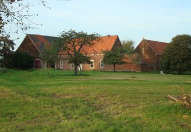
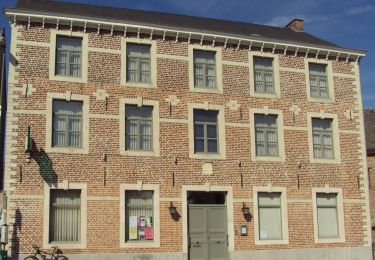
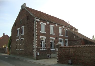
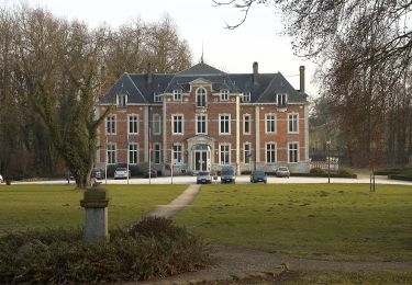
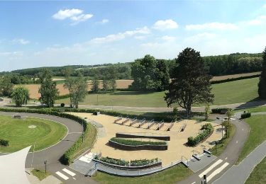
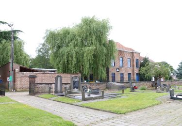
Randonnée A pied de 7,6 km à découvrir à Flandre, Brabant flamand, Bierbeek. Cette randonnée est proposée par SityTrail - itinéraires balisés pédestres.
Description
Randonnée créée par Toerisme Vlaams-Brabant.
Symbole: hexagon
Localisation
Pays :
Belgique
Région :
Flandre
Département/Province :
Brabant flamand
Commune :
Bierbeek
Localité :
Lovenjoel
Départ:(Dec)
Départ:(UTM)
625474 ; 5635006 (31U) N.
Commentaires
Randonnées à proximité
![Randonnée Marche Louvain - Entre Louvain et Holsbeek - Photo](https://media.geolcdn.com/t/375/260/ext.jpg?maxdim=2&url=https%3A%2F%2Fmedia.geolcdn.com%2Ff%2F6144a09e-b9f6-4936-bd2f-90e77722db59.jpeg)
![Marche Marche](https://static1.geolcdn.com/sitytour/trail-icons/101.png)
Entre Louvain et Holsbeek
Marche
Moyen
(2)
Louvain,
Flandre,
Brabant flamand,
Belgique
![](/images/other/stat-length.png)
18,1 km | 22 km-effort
5h 1min
![](https://static1.geolcdn.com/siteimages/upload/files/16400158638029165_repeat_loop_refresh_sync_direction_icon.png)
Oui
![Randonnée A pied Bierbeek - Walterpad variant B - Photo](https://media.geolcdn.com/t/375/260/ext.jpg?maxdim=2&url=https%3A%2F%2Fmedia.geolcdn.com%2Ff%2F97f167cf-343d-4614-b53d-0bf567721674.jpeg)
![A pied A pied](https://static1.geolcdn.com/sitytour/trail-icons/100.png)
Walterpad variant B
A pied
Facile
Bierbeek,
Flandre,
Brabant flamand,
Belgique
![](/images/other/stat-length.png)
11,8 km | 13,2 km-effort
2h 59min
![](https://static1.geolcdn.com/siteimages/upload/files/16400158638029165_repeat_loop_refresh_sync_direction_icon.png)
Oui
![Randonnée A pied Bierbeek - Walterpad variant A - Photo](https://media.geolcdn.com/t/375/260/ext.jpg?maxdim=2&url=https%3A%2F%2Fmedia.geolcdn.com%2Ff%2F9d093022-83a0-407b-8940-77a39f7cbc36.jpeg)
![A pied A pied](https://static1.geolcdn.com/sitytour/trail-icons/100.png)
Walterpad variant A
A pied
Facile
Bierbeek,
Flandre,
Brabant flamand,
Belgique
![](/images/other/stat-length.png)
10,9 km | 12,1 km-effort
2h 45min
![](https://static1.geolcdn.com/siteimages/upload/files/16400158638029165_repeat_loop_refresh_sync_direction_icon.png)
Oui
![Randonnée A pied Lubbeek - Werveldtwandelpad - Photo](https://media.geolcdn.com/t/375/260/ext.jpg?maxdim=2&url=https%3A%2F%2Fmedia.geolcdn.com%2Ff%2Fded3d43f-7a42-4b37-9a96-cc33917bc035.jpeg)
![A pied A pied](https://static1.geolcdn.com/sitytour/trail-icons/100.png)
Werveldtwandelpad
A pied
Facile
Lubbeek,
Flandre,
Brabant flamand,
Belgique
![](/images/other/stat-length.png)
9,4 km | 10,7 km-effort
2h 25min
![](https://static1.geolcdn.com/siteimages/upload/files/16400158638029165_repeat_loop_refresh_sync_direction_icon.png)
Oui
![Randonnée A pied Bierbeek - Hollewegenwandelpad - Photo](https://media.geolcdn.com/t/375/260/ext.jpg?maxdim=2&url=https%3A%2F%2Fmedia.geolcdn.com%2Ff%2F58a21a26-c364-46a8-866b-beae515c5750.jpeg)
![A pied A pied](https://static1.geolcdn.com/sitytour/trail-icons/100.png)
Hollewegenwandelpad
A pied
Facile
Bierbeek,
Flandre,
Brabant flamand,
Belgique
![](/images/other/stat-length.png)
8,5 km | 9,4 km-effort
2h 8min
![](https://static1.geolcdn.com/siteimages/upload/files/16400158638029165_repeat_loop_refresh_sync_direction_icon.png)
Oui
![Randonnée A pied Boutersem - Kleine Kringwandelpad - Photo](https://media.geolcdn.com/t/375/260/ext.jpg?maxdim=2&url=https%3A%2F%2Fmedia.geolcdn.com%2Ff%2F921c562e-84e1-448b-b0e1-9555ca637c1e.jpeg)
![A pied A pied](https://static1.geolcdn.com/sitytour/trail-icons/100.png)
Kleine Kringwandelpad
A pied
Facile
Boutersem,
Flandre,
Brabant flamand,
Belgique
![](/images/other/stat-length.png)
11,1 km | 12,3 km-effort
2h 48min
![](https://static1.geolcdn.com/siteimages/upload/files/16400158638029165_repeat_loop_refresh_sync_direction_icon.png)
Oui
![Randonnée A pied Boutersem - Velpehoevewandelpad - Photo](https://media.geolcdn.com/t/375/260/ext.jpg?maxdim=2&url=https%3A%2F%2Fmedia.geolcdn.com%2Ff%2F32694a94-9124-4a9f-8730-155bd3fc653c.jpeg)
![A pied A pied](https://static1.geolcdn.com/sitytour/trail-icons/100.png)
Velpehoevewandelpad
A pied
Facile
Boutersem,
Flandre,
Brabant flamand,
Belgique
![](/images/other/stat-length.png)
8,7 km | 9,8 km-effort
2h 13min
![](https://static1.geolcdn.com/siteimages/upload/files/16400158638029165_repeat_loop_refresh_sync_direction_icon.png)
Oui
![Randonnée A pied Lubbeek - Koebos Rode driehoek - Photo](https://media.geolcdn.com/t/375/260/ext.jpg?maxdim=2&url=https%3A%2F%2Fmedia.geolcdn.com%2Ff%2F5c20d123-ec17-4589-930d-f0e497ca53fb.jpeg)
![A pied A pied](https://static1.geolcdn.com/sitytour/trail-icons/100.png)
Koebos Rode driehoek
A pied
Facile
Lubbeek,
Flandre,
Brabant flamand,
Belgique
![](/images/other/stat-length.png)
10,5 km | 12,5 km-effort
2h 50min
![](https://static1.geolcdn.com/siteimages/upload/files/16400158638029165_repeat_loop_refresh_sync_direction_icon.png)
Oui
![Randonnée A pied Bierbeek - Koebos Oranje bol - Photo](https://media.geolcdn.com/t/375/260/ext.jpg?maxdim=2&url=https%3A%2F%2Fmedia.geolcdn.com%2Ff%2F19ba822f-7c4a-4bc9-8aae-eb593823c4b1.jpeg)
![A pied A pied](https://static1.geolcdn.com/sitytour/trail-icons/100.png)
Koebos Oranje bol
A pied
Facile
Bierbeek,
Flandre,
Brabant flamand,
Belgique
![](/images/other/stat-length.png)
5,9 km | 6,9 km-effort
1h 34min
![](https://static1.geolcdn.com/siteimages/upload/files/16400158638029165_repeat_loop_refresh_sync_direction_icon.png)
Oui