Randonnée A pied Wissembourg - Grenzland Tour Schweigen-Rechtenbach - Photo

Grenzland Tour Schweigen-Rechtenbach

Tous les sentiers balisés d’Europe GUIDE+

© OpenStreetMap contributors
Longueur
Longueur
11,3 km
Altitude max
Altitude max
404 m
Dénivelé positif
Dénivelé positif
311 m
Km-Effort
Km-Effort  
15,5 km
Altitude min
Altitude min
213 m
Dénivelé négatif
Dénivelé négatif
309 m
Boucle
Boucle
Oui
Balise
Balise
Date de création :
2022-02-11 17:18:56.326
Dernière modification :
2022-03-02 08:29:44.89

(0 Avis)

A pied
A pied
3h30
Difficulté : Facile

Scannez ce code QR pour ouvrir la randonnée dans l'application SityTrail

Application GPS de randonnée GRATUITE

Logo SityTrail SityTrail

IGN / Instituts géographiques

Télécharger SityTrail sur l'App Store Télécharger SityTrail sur Google Play

Logo SityTrail SityTrail World

Le monde est à vous

Télécharger SityTrail sur l'App Store Télécharger SityTrail sur Google Play Télécharger SityTrail sur Huawei AppGallery

À propos

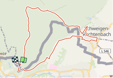
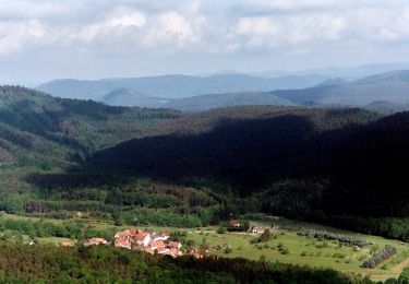
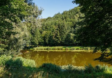
Randonnée A pied de 11,3 km à découvrir à Grand Est, Bas-Rhin, Wissembourg. Cette randonnée est proposée par SityTrail - itinéraires balisés pédestres.

Description

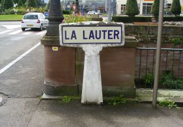
Die Markierung im Gelände stimmt nicht mit dem gpx Track im Internet überein

Symbole: 2 violette Fahnen auf weißem Grund

Profil altimétrique

Photos

Localisation

Pays :
France
Région :
Grand Est
Département/Province :
Bas-Rhin
Commune :
Wissembourg
Localité :
Unknown
Départ:(UTM)
420609 ; 5432659 (32U) N.

Randonnées à proximité

Randonnée A pied Cleebourg - Disque jaune - Photo
A pied
GUIDE+

A pied

Moyen
Cleebourg, Grand Est, Bas-Rhin, France
20 km | 27 km-effort
6h 13min
Non
Randonnée A pied Wissembourg - Rotes Kreuz - Photo
A pied
GUIDE+

A pied

Facile
Wissembourg, Grand Est, Bas-Rhin, France
6,5 km | 9,6 km-effort
2h 11min
Non
Randonnée A pied Wissembourg - Disque vert - Photo
A pied
GUIDE+

A pied

Facile
Wissembourg, Grand Est, Bas-Rhin, France
8,9 km | 12,9 km-effort
2h 56min
Non
Randonnée A pied Wissembourg - Anneau rouge - Photo
A pied
GUIDE+

A pied

Facile
Wissembourg, Grand Est, Bas-Rhin, France
7,4 km | 9,6 km-effort
2h 11min
Oui
Randonnée A pied Wissembourg - Anneau vert - Photo
A pied
GUIDE+

A pied

Facile
Wissembourg, Grand Est, Bas-Rhin, France
13,5 km | 18,3 km-effort
4h 9min
Oui
Randonnée A pied Bobenthal - Hasenkopf-Runde - Photo
A pied
GUIDE+

A pied

Facile
Bobenthal, Rhénanie-Palatinat, Südwestpfalz, Allemagne
7,9 km | 10,9 km-effort
2h 28min
Non
Randonnée A pied Bobenthal - Hirzeck-Gipfel-Steig - Photo
A pied
GUIDE+

A pied

Facile
Bobenthal, Rhénanie-Palatinat, Südwestpfalz, Allemagne
14,1 km | 19,3 km-effort
4h 22min
Oui
Randonnée A pied Dörrenbach - Weg der Aussichten, Dörrenbach - Photo
A pied
GUIDE+

A pied

Facile
Dörrenbach, Rhénanie-Palatinat, Landkreis Südliche Weinstraße, Allemagne
5,3 km | 7,9 km-effort
1h 47min
Non
Randonnée A pied Schweigen-Rechtenbach - Rund ums Steinbühl Schweigen-Rechtenbach - Photo
A pied
GUIDE+

A pied

Facile
Schweigen-Rechtenbach, Rhénanie-Palatinat, Landkreis Südliche Weinstraße, Allemagne
7,8 km | 11,1 km-effort
2h 31min
Non


Fermer
Mes abonnements