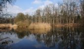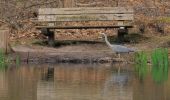
Warnsborn
SityTrail - itinéraires balisés pédestres
Tous les sentiers balisés d’Europe GUIDE+

Longueur
4,9 km

Altitude max
71 m

Dénivelé positif
62 m

Km-Effort
5,7 km

Altitude min
28 m

Dénivelé négatif
65 m
Boucle
Oui

Balise
Date de création :
2022-02-14 14:31:11.034
Dernière modification :
2022-02-14 14:31:11.034
1h18
Difficulté : Facile

Application GPS de randonnée GRATUITE
À propos
Randonnée A pied de 4,9 km à découvrir à Gueldre, Inconnu, Arnhem. Cette randonnée est proposée par SityTrail - itinéraires balisés pédestres.
Description
Hoog Erf bestaat uit weilanden, akkers, loofbosjes en singels. Een mooi punt is ‘de ster’. Hier komen zes lanen van het landgoed bij elkaar. Een heerl
Site web: https://www.glk.nl/landschappen-kastelen/locatie/hoog-erf
Localisation
Pays :
Pays-Bas
Région :
Gueldre
Département/Province :
Inconnu
Commune :
Arnhem
Localité :
Unknown
Départ:(Dec)
Départ:(UTM)
695951 ; 5765785 (31U) N.
Commentaires


 SityTrail


