Randonnée A pied Ribeirinha - Ribeirinha - Photo

Tous les sentiers balisés d’Europe PRO

© OpenStreetMap contributors
Longueur
Longueur
8 km
Altitude max
Altitude max
388 m
Dénivelé positif
Dénivelé positif
442 m
Km-Effort
Km-Effort  
13,9 km
Altitude min
Altitude min
8 m
Dénivelé négatif
Dénivelé négatif
447 m
Boucle
Boucle
Oui
Balise
Balise
Date de création :
2022-02-14 15:17:32.391
Dernière modification :
2022-02-14 15:17:32.391

(0 Avis)

A pied
A pied
3h09
Difficulté : Facile

Scannez ce code QR pour ouvrir la randonnée dans l'application SityTrail

Application GPS de randonnée GRATUITE

Logo SityTrail SityTrail

IGN / Instituts géographiques

Télécharger SityTrail sur l'App Store Télécharger SityTrail sur Google Play

Logo SityTrail SityTrail World

Le monde est à vous

Télécharger SityTrail sur l'App Store Télécharger SityTrail sur Google Play Télécharger SityTrail sur Huawei AppGallery

À propos

Randonnée A pied de 8 km à découvrir à Açores, Inconnu, Ribeirinha. Cette randonnée est proposée par SityTrail - itinéraires balisés pédestres.

Description

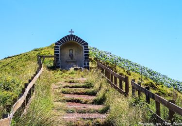
This circular route in the village of Ribeirinha evolves partially in the protected area for habitats and species management of Lomba Grande and the Graben of Pedro Miguel, one of the main Geosites of the Archipelago. Also known as the volcanic complex of Ribeirinha, represents the oldest part of the island with around 800 thousand years. Begin the trail in the center of the

Site web: http://trails.visitazores.com/en/trails-azores/faial/ribeirinha

Photos

Localisation

Pays :
Portugal
Région :
Açores
Département/Province :
Inconnu
Commune :
Ribeirinha
Localité :
Unknown
Départ:(UTM)
359143 ; 4273372 (26S) N.

Randonnées à proximité

Randonnée A pied  - Caminhos Velhos - Photo
A pied
PRO

A pied

Moyen
, Açores, , Portugal
15,6 km | 28 km-effort
6h 15min
Non


Fermer
Mes abonnements