


jour 2

Tommy Eric
Utilisateur
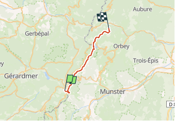

Longueur
23 km

Altitude max
1352 m

Dénivelé positif
682 m
Km-Effort
33 km

Altitude min
933 m

Dénivelé négatif
937 m
Boucle
Non
Date de création :
2022-05-26 07:12:29.184
Dernière modification :
2022-05-26 16:09:02.514
8h47
Difficulté : Très difficile

Application GPS de randonnée GRATUITE
 SityTrail
IGN / Instituts géographiques
SityTrail Plus
Le monde est à vous
À propos
Randonnée Marche de 23 km à découvrir à Grand Est, Vosges, Xonrupt-Longemer. Cette randonnée est proposée par Tommy Eric.
Localisation
Pays :
France
Région :
Grand Est
Département/Province :
Vosges
Commune :
Xonrupt-Longemer
Localité :
Unknown
Départ:(Dec)
Départ:(UTM)
351150 ; 5323007 (32U) N.
Commentaires