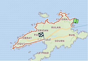
![](/images/other/stat-length.png)
![Randonnée Marche Ouessant - Côte Nord de l'ïle d'Ouessant - Photo](https://media.geolcdn.com/t/1900/400/ext.pjpeg?maxdim=2&url=https%3A%2F%2Fmedia.geolcdn.com%2Ff%2F06660439-6893-4e8d-8d37-f3d6f81e76d9.jpg)
Côte Nord de l'ïle d'Ouessant
ilur56
Utilisateur
![Longueur](/images/other/stat-length.png)
Longueur
18,3 km
![Altitude max](https://static1.geolcdn.com/siteimages/upload/files/1508320355ic_sort_altitude_max_24dp.png)
Altitude max
74 m
![Dénivelé positif](https://static1.geolcdn.com/siteimages/upload/files/1508320355ic_sort_den_pos_24dp.png)
Dénivelé positif
256 m
![Km-Effort](/images/other/stat-length.png)
Km-Effort
22 km
![Altitude min](https://static1.geolcdn.com/siteimages/upload/files/1508320355ic_sort_altitude_min_24dp.png)
Altitude min
0 m
![Dénivelé négatif](https://static1.geolcdn.com/siteimages/upload/files/1508320355ic_sort_den_neg_24dp.png)
Dénivelé négatif
265 m
![Boucle](https://static1.geolcdn.com/siteimages/upload/files/16400158638029165_repeat_loop_refresh_sync_direction_icon.png)
Boucle
Non
Date de création :
2022-09-05 07:41:29.498
Dernière modification :
2022-09-09 12:34:25.087
![Marche](https://static1.geolcdn.com/sitytour/trail-icons/101.png)
4h52
Difficulté : Moyen
![Scannez ce code QR pour ouvrir la randonnée dans l'application SityTrail](https://capi.geolives.com/qq0zvz2zws4bq2lad0pu/sitytour/trails/3380410/qr.png?size=200)
Application GPS de randonnée GRATUITE
À propos
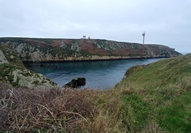
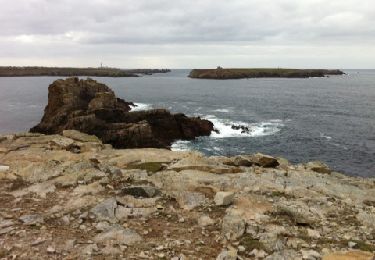
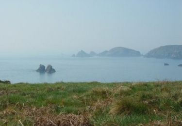
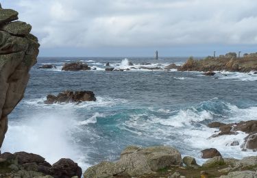
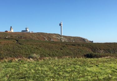
Randonnée Marche de 18,3 km à découvrir à Bretagne, Finistère, Ouessant. Cette randonnée est proposée par ilur56.
Description
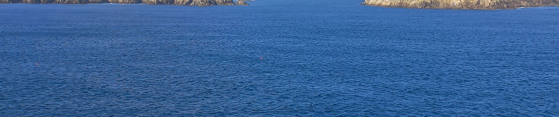
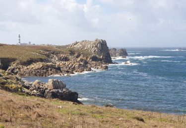
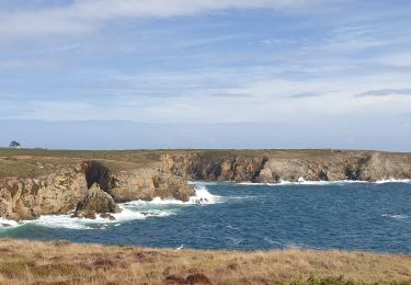
Trajet en bus jusqu'à l'embarcadère du Stiff du bourg de Lampaul; Retour sur le sentier côtier jusqu'au bourg de Lampaul
Localisation
Pays :
France
Région :
Bretagne
Département/Province :
Finistère
Commune :
Ouessant
Localité :
Unknown
Départ:(Dec)
Départ:(UTM)
347990 ; 5370524 (30U) N.
Commentaires
Randonnées à proximité
![Randonnée Marche Ouessant - OUESSANT - Photo](https://media.geolcdn.com/t/375/260/ext.jpg?maxdim=2&url=https%3A%2F%2Fmedia.geolcdn.com%2Ff%2Fdd2cb79a-8cf5-4140-b9c0-e088dc077526.jpg)
![Marche Marche](https://static1.geolcdn.com/sitytour/trail-icons/101.png)
![Randonnée Marche Ouessant - Lampaul - Lampaul - Photo](https://media.geolcdn.com/t/375/260/ext.jpg?maxdim=2&url=https%3A%2F%2Fmedia.geolcdn.com%2Ff%2F735eea88-441b-4cbf-8486-c86257c9e418.jpg)
![Marche Marche](https://static1.geolcdn.com/sitytour/trail-icons/101.png)
Lampaul - Lampaul
Marche
Facile
Ouessant,
Bretagne,
Finistère,
France
![](/images/other/stat-length.png)
10,4 km | 11,9 km-effort
3h 10min
![](https://static1.geolcdn.com/siteimages/upload/files/16400158638029165_repeat_loop_refresh_sync_direction_icon.png)
Oui
![Randonnée Marche Ouessant - Port Ouessant - Lampaul - Photo](https://media.geolcdn.com/t/375/260/ext.jpg?maxdim=2&url=https%3A%2F%2Fmedia.geolcdn.com%2Ff%2Fdd1f64a7-7b2a-4ab0-b289-7db55f2cc849.jpg)
![Marche Marche](https://static1.geolcdn.com/sitytour/trail-icons/101.png)
Port Ouessant - Lampaul
Marche
Facile
Ouessant,
Bretagne,
Finistère,
France
![](/images/other/stat-length.png)
8,9 km | 10,6 km-effort
2h 26min
![](https://static1.geolcdn.com/siteimages/upload/files/16400158638029165_repeat_loop_refresh_sync_direction_icon.png)
Non
![Randonnée Marche Ouessant - Tour d'Ouessant au départ du Stiff - Photo](https://media.geolcdn.com/t/375/260/ext.jpg?maxdim=2&url=https%3A%2F%2Fservices.sitytrail.com%2FGeolivesWS%2FDownloadMedia.ashx%3FTrailID%3D1091788%26Media%3Dfix__20181230150740.jpg)
![Marche Marche](https://static1.geolcdn.com/sitytour/trail-icons/101.png)
Tour d'Ouessant au départ du Stiff
Marche
Moyen
Ouessant,
Bretagne,
Finistère,
France
![](/images/other/stat-length.png)
50 km | 58 km-effort
13h 18min
![](https://static1.geolcdn.com/siteimages/upload/files/16400158638029165_repeat_loop_refresh_sync_direction_icon.png)
Oui
![Randonnée Marche Ouessant - houassan île - Photo](https://media.geolcdn.com/t/375/260/ext.jpg?maxdim=2&url=https%3A%2F%2Fstatic1.geolcdn.com%2Fsiteimages%2Fupload%2Ffiles%2F1553511878bg_sport_marche.png)
![Marche Marche](https://static1.geolcdn.com/sitytour/trail-icons/101.png)
houassan île
Marche
Très facile
(1)
Ouessant,
Bretagne,
Finistère,
France
![](/images/other/stat-length.png)
13,2 km | 15 km-effort
5h 11min
![](https://static1.geolcdn.com/siteimages/upload/files/16400158638029165_repeat_loop_refresh_sync_direction_icon.png)
Non
![Randonnée Autre activité Ouessant - 121107 Ouessant - Photo](https://media.geolcdn.com/t/375/260/ext.jpg?maxdim=2&url=https%3A%2F%2Fservices.sitytrail.com%2FGeolivesWS%2FDownloadMedia.ashx%3FTrailID%3D161803%26Media%3D20121107151847.jpg)
![Autre activité Autre activité](https://static1.geolcdn.com/sitytour/trail-icons/900.png)
121107 Ouessant
Autre activité
Très facile
Ouessant,
Bretagne,
Finistère,
France
![](/images/other/stat-length.png)
18,8 km | 21 km-effort
4h 23min
![](https://static1.geolcdn.com/siteimages/upload/files/16400158638029165_repeat_loop_refresh_sync_direction_icon.png)
Non
![Randonnée Marche Ouessant - Ile d'Ouessant - rando gps - Photo](https://media.geolcdn.com/t/375/260/ext.jpg?maxdim=2&url=https%3A%2F%2Fservices.sitytrail.com%2FGeolivesWS%2FDownloadMedia.ashx%3FTrailID%3D101374%26Media%3D1121_3.jpg)
![Marche Marche](https://static1.geolcdn.com/sitytour/trail-icons/101.png)
Ile d'Ouessant - rando gps
Marche
Très difficile
(1)
Ouessant,
Bretagne,
Finistère,
France
![](/images/other/stat-length.png)
27 km | 31 km-effort
7h 0min
![](https://static1.geolcdn.com/siteimages/upload/files/16400158638029165_repeat_loop_refresh_sync_direction_icon.png)
Oui
![Randonnée Marche Ouessant - Pointe de Pern à Ouessant - Photo](https://media.geolcdn.com/t/375/260/ext.jpg?maxdim=2&url=https%3A%2F%2Fmedia.geolcdn.com%2Ff%2Ff4230dd3-28a0-4360-a360-b4535fb3ff0f.jpg)
![Marche Marche](https://static1.geolcdn.com/sitytour/trail-icons/101.png)
Pointe de Pern à Ouessant
Marche
Facile
Ouessant,
Bretagne,
Finistère,
France
![](/images/other/stat-length.png)
11,6 km | 13,4 km-effort
3h 12min
![](https://static1.geolcdn.com/siteimages/upload/files/16400158638029165_repeat_loop_refresh_sync_direction_icon.png)
Oui
![Randonnée Course à pied Ouessant - Île d’Ouessant-20092019 - Photo](https://media.geolcdn.com/t/375/260/ext.jpg?maxdim=2&url=https%3A%2F%2Fmedia.geolcdn.com%2Ff%2F3e6955f2-161a-42fa-ab6d-55561f29f168.jpg)
![Course à pied Course à pied](https://static1.geolcdn.com/sitytour/trail-icons/103.png)
Île d’Ouessant-20092019
Course à pied
Très difficile
Ouessant,
Bretagne,
Finistère,
France
![](/images/other/stat-length.png)
33 km | 39 km-effort
5h 29min
![](https://static1.geolcdn.com/siteimages/upload/files/16400158638029165_repeat_loop_refresh_sync_direction_icon.png)
Oui