Randonnée Marche Charly - Charly-Millery-Charly par bords Rhône.  - Photo

Charly-Millery-Charly par bords Rhône.

 dan69390
dan69390

Utilisateur

© OpenStreetMap contributors
Longueur
Longueur
7,9 km
Altitude max
Altitude max
298 m
Dénivelé positif
Dénivelé positif
160 m
Km-Effort
Km-Effort  
10 km
Altitude min
Altitude min
157 m
Dénivelé négatif
Dénivelé négatif
160 m
Boucle
Boucle
Oui
Date de création :
2014-12-10 00:00:00.0
Dernière modification :
2014-12-10 00:00:00.0

(2 Avis)

Marche
Marche
1h46
Difficulté : Inconnu

Scannez ce code QR pour ouvrir la randonnée dans l'application SityTrail

Application GPS de randonnée GRATUITE

Logo SityTrail SityTrail

IGN / Instituts géographiques

Télécharger SityTrail sur l'App Store Télécharger SityTrail sur Google Play

Logo SityTrail SityTrail World

Le monde est à vous

Télécharger SityTrail sur l'App Store Télécharger SityTrail sur Google Play Télécharger SityTrail sur Huawei AppGallery

À propos

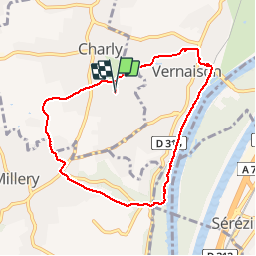
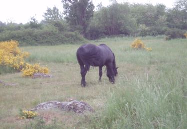
Randonnée Marche de 7,9 km à découvrir à Auvergne-Rhône-Alpes, Métropole de Lyon, Charly. Cette randonnée est proposée par dan69390.

Profil altimétrique

Localisation

Pays :
France
Région :
Auvergne-Rhône-Alpes
Département/Province :
Métropole de Lyon
Commune :
Charly
Localité :
Unknown
Départ:(Dec)
Départ:(UTM)
640081 ; 5056114 (31T) N.

Commentaires

Veuillez vous connecter pour laisser un commentaire ou une note


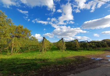
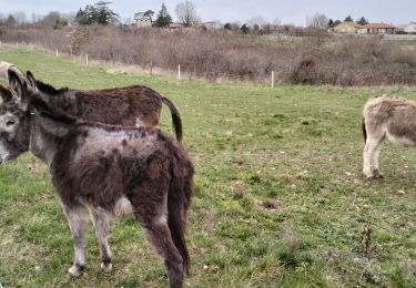
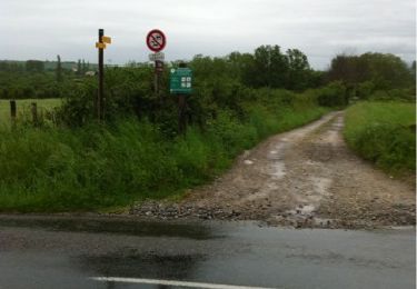
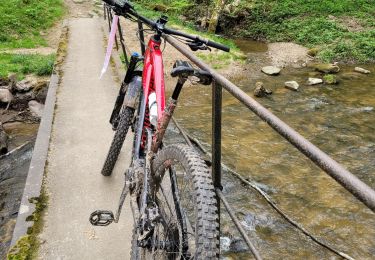
Joli coin, mais beaucoup de goudron ! les chemins non goudronnés fatiguent moins le dos.


Randonnées à proximité

Randonnée Marche Brignais - de brigais à Orlienas - Photo
Marche
maclobar

Marche

Moyen
(1)
Brignais, Auvergne-Rhône-Alpes, Rhône, France
9,2 km | 11,6 km-effort
2h 6min
Oui
Randonnée Marche Vernaison - 69-Vernaisonlesforts12km170m - Photo
Marche
SyMA

Marche

Moyen
Vernaison, Auvergne-Rhône-Alpes, Métropole de Lyon, France
12,4 km | 14,7 km-effort
3h 25min
Oui
Randonnée Marche Millery - Exercice terrain 2 - Photo
Marche
Jean-Marc Gally

Marche

Facile
(1)
Millery, Auvergne-Rhône-Alpes, Rhône, France
2,1 km | 2,5 km-effort
33min
Non
Randonnée V.T.T. Vernaison - first test - Photo
V.T.T.
beb69

V.T.T.

Très facile
(2)
Vernaison, Auvergne-Rhône-Alpes, Métropole de Lyon, France
21 km | 27 km-effort
1h 5min
Oui
Randonnée Marche Montagny - De Montagny à Chassagny  - Photo
Marche
tracegps

Marche

Moyen
(1)
Montagny, Auvergne-Rhône-Alpes, Rhône, France
10 km | 12,9 km-effort
2h 30min
Oui
Randonnée V.T.T. Vernaison - charly - Photo
V.T.T.
marc6262

V.T.T.

Difficile
Vernaison, Auvergne-Rhône-Alpes, Métropole de Lyon, France
54 km | 69 km-effort
3h 48min
Non
Randonnée Marche Vernaison - De vergers en pâturages N°3 Topo Grand Lyon à pied - Photo
Marche
chuck

Marche

Facile
Vernaison, Auvergne-Rhône-Alpes, Métropole de Lyon, France
15,2 km | 18 km-effort
4h 5min
Oui
Randonnée Marche Beauvallon - chassagny2023 - Photo
Marche
cacrhone

Marche

Moyen
Beauvallon, Auvergne-Rhône-Alpes, Rhône, France
7,8 km | 10 km-effort
2h 53min
Non
Randonnée Marche Communay - communay 1 - Photo
Marche
AlixJ3

Marche

Très difficile
Communay, Auvergne-Rhône-Alpes, Rhône, France
16 km | 19,9 km-effort
4h 30min
Oui


Fermer
Mes abonnements