![](/images/other/stat-length.png)
![Randonnée Marche Villemagne-l'Argentière - Boussagues - Photo](https://media.geolcdn.com/t/1900/400/ext.pjpeg?maxdim=2&url=https%3A%2F%2Fmedia.geolcdn.com%2Ff%2Fbe08c2e4-1762-4385-aef6-316aec3868b5.jpg)
Boussagues
Raymond DAVID
Utilisateur
![Longueur](/images/other/stat-length.png)
Longueur
16 km
![Altitude max](https://static1.geolcdn.com/siteimages/upload/files/1508320355ic_sort_altitude_max_24dp.png)
Altitude max
471 m
![Dénivelé positif](https://static1.geolcdn.com/siteimages/upload/files/1508320355ic_sort_den_pos_24dp.png)
Dénivelé positif
427 m
![Km-Effort](/images/other/stat-length.png)
Km-Effort
22 km
![Altitude min](https://static1.geolcdn.com/siteimages/upload/files/1508320355ic_sort_altitude_min_24dp.png)
Altitude min
204 m
![Dénivelé négatif](https://static1.geolcdn.com/siteimages/upload/files/1508320355ic_sort_den_neg_24dp.png)
Dénivelé négatif
427 m
![Boucle](https://static1.geolcdn.com/siteimages/upload/files/16400158638029165_repeat_loop_refresh_sync_direction_icon.png)
Boucle
Oui
Date de création :
2022-10-02 07:15:04.743
Dernière modification :
2022-10-03 07:43:09.733
![Marche](https://static1.geolcdn.com/sitytour/trail-icons/101.png)
4h30
Difficulté : Moyen
![Scannez ce code QR pour ouvrir la randonnée dans l'application SityTrail](https://capi.geolives.com/qq0zvz2zws4bq2lad0pu/sitytour/trails/3411114/qr.png?size=200)
Application GPS de randonnée GRATUITE
À propos
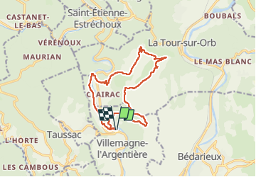
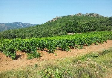
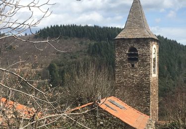
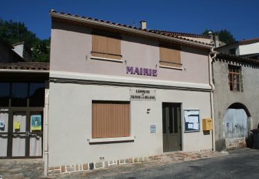
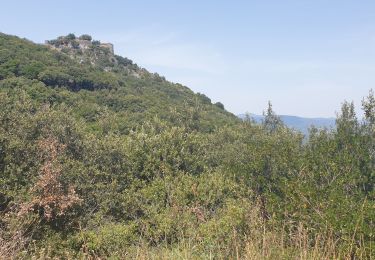
Randonnée Marche de 16 km à découvrir à Occitanie, Hérault, Villemagne-l'Argentière. Cette randonnée est proposée par Raymond DAVID .
Description
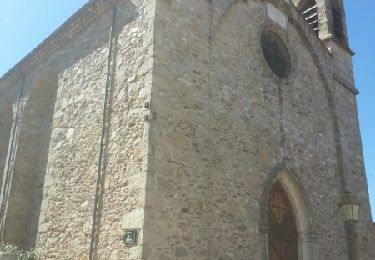
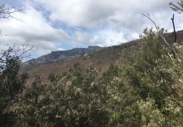
Belle randonnée entre causses et garrigues avec le pont du Diable au départ et à l'arrivée. Prendre le temps de visiter Boussagues.
Localisation
Pays :
France
Région :
Occitanie
Département/Province :
Hérault
Commune :
Villemagne-l'Argentière
Localité :
Unknown
Départ:(Dec)
Départ:(UTM)
509488 ; 4830202 (31T) N.
Commentaires
Randonnées à proximité
![Randonnée Marche Hérépian - herepian pic de Tantajo - Photo](https://media.geolcdn.com/t/375/260/ext.jpg?maxdim=2&url=https%3A%2F%2Fservices.sitytrail.com%2FGeolivesWS%2FDownloadMedia.ashx%3FTrailID%3D656804%26Media%3D20161106140841.jpg)
![Marche Marche](https://static1.geolcdn.com/sitytour/trail-icons/101.png)
herepian pic de Tantajo
Marche
Facile
(1)
Hérépian,
Occitanie,
Hérault,
France
![](/images/other/stat-length.png)
13 km | 18,6 km-effort
4h 17min
![](https://static1.geolcdn.com/siteimages/upload/files/16400158638029165_repeat_loop_refresh_sync_direction_icon.png)
Oui
![Randonnée Vélo Villemagne-l'Argentière - bedarieux. Mons la trivale par la voie verte allé retour - Photo](https://media.geolcdn.com/t/375/260/ext.jpg?maxdim=2&url=https%3A%2F%2Fservices.sitytrail.com%2FGeolivesWS%2FDownloadMedia.ashx%3FTrailID%3D217102%26Media%3D20130827171314.jpg)
![Vélo Vélo](https://static1.geolcdn.com/sitytour/trail-icons/200.png)
bedarieux. Mons la trivale par la voie verte allé retour
Vélo
Très facile
(2)
Villemagne-l'Argentière,
Occitanie,
Hérault,
France
![](/images/other/stat-length.png)
31 km | 37 km-effort
3h 11min
![](https://static1.geolcdn.com/siteimages/upload/files/16400158638029165_repeat_loop_refresh_sync_direction_icon.png)
Non
![Randonnée Marche Taussac-la-Billière - orgues de taussac - Photo](https://media.geolcdn.com/t/375/260/ext.jpg?maxdim=2&url=https%3A%2F%2Fservices.sitytrail.com%2FGeolivesWS%2FDownloadMedia.ashx%3FTrailID%3D145474%26Media%3D20120811112610.jpeg)
![Marche Marche](https://static1.geolcdn.com/sitytour/trail-icons/101.png)
orgues de taussac
Marche
Facile
(2)
Taussac-la-Billière,
Occitanie,
Hérault,
France
![](/images/other/stat-length.png)
9,3 km | 14,2 km-effort
3h 1min
![](https://static1.geolcdn.com/siteimages/upload/files/16400158638029165_repeat_loop_refresh_sync_direction_icon.png)
Oui
![Randonnée Marche Les Aires - Saint Michel la coquillade - Photo](https://media.geolcdn.com/t/375/260/ext.jpg?maxdim=2&url=https%3A%2F%2Fservices.sitytrail.com%2FGeolivesWS%2FDownloadMedia.ashx%3FTrailID%3D419022%26Media%3Dfix__20150406153326.jpg)
![Marche Marche](https://static1.geolcdn.com/sitytour/trail-icons/101.png)
Saint Michel la coquillade
Marche
Moyen
(1)
Les Aires,
Occitanie,
Hérault,
France
![](/images/other/stat-length.png)
13,2 km | 21 km-effort
4h 7min
![](https://static1.geolcdn.com/siteimages/upload/files/16400158638029165_repeat_loop_refresh_sync_direction_icon.png)
Oui
![Randonnée Marche Hérépian - vallée des arômes - Photo](https://media.geolcdn.com/t/375/260/ext.jpg?maxdim=2&url=https%3A%2F%2Fmedia.geolcdn.com%2Ff%2Fc6753d91-15fa-4844-b595-c6b7592a45cf.jpg)
![Marche Marche](https://static1.geolcdn.com/sitytour/trail-icons/101.png)
vallée des arômes
Marche
Moyen
Hérépian,
Occitanie,
Hérault,
France
![](/images/other/stat-length.png)
13,4 km | 17,4 km-effort
3h 11min
![](https://static1.geolcdn.com/siteimages/upload/files/16400158638029165_repeat_loop_refresh_sync_direction_icon.png)
Oui
![Randonnée Marche Le Poujol-sur-Orb - Rando Seviracttt - Photo](https://media.geolcdn.com/t/375/260/ext.jpg?maxdim=2&url=https%3A%2F%2Fmedia.geolcdn.com%2Ff%2Fabbb6ad5-7718-434b-be19-2e67e5d9637f.jpg)
![Marche Marche](https://static1.geolcdn.com/sitytour/trail-icons/101.png)
Rando Seviracttt
Marche
Très difficile
Le Poujol-sur-Orb,
Occitanie,
Hérault,
France
![](/images/other/stat-length.png)
14,9 km | 21 km-effort
4h 40min
![](https://static1.geolcdn.com/siteimages/upload/files/16400158638029165_repeat_loop_refresh_sync_direction_icon.png)
Oui
![Randonnée Marche Combes - Le Fraïsse (Villecelle) - Col des Princes - Saint-Vital - Combes - Torteillan - Photo](https://media.geolcdn.com/t/375/260/ext.jpg?maxdim=2&url=https%3A%2F%2Fmedia.geolcdn.com%2Ff%2F2abe5219-7c42-4fb2-835f-54e3fc346f74.jpg)
![Marche Marche](https://static1.geolcdn.com/sitytour/trail-icons/101.png)
Le Fraïsse (Villecelle) - Col des Princes - Saint-Vital - Combes - Torteillan
Marche
Difficile
(1)
Combes,
Occitanie,
Hérault,
France
![](/images/other/stat-length.png)
13,5 km | 20 km-effort
4h 25min
![](https://static1.geolcdn.com/siteimages/upload/files/16400158638029165_repeat_loop_refresh_sync_direction_icon.png)
Oui
![Randonnée A pied Lamalou-les-Bains - Circuit Le Roc de Bessèdes - Photo](https://media.geolcdn.com/t/375/260/ext.jpg?maxdim=2&url=https%3A%2F%2Fmedia.geolcdn.com%2Ff%2F4a77a7d1-879d-4866-911a-476d955f0998.jpeg)
![A pied A pied](https://static1.geolcdn.com/sitytour/trail-icons/100.png)
Circuit Le Roc de Bessèdes
A pied
Facile
Lamalou-les-Bains,
Occitanie,
Hérault,
France
![](/images/other/stat-length.png)
11,2 km | 17,6 km-effort
3h 59min
![](https://static1.geolcdn.com/siteimages/upload/files/16400158638029165_repeat_loop_refresh_sync_direction_icon.png)
Oui
![Randonnée Marche Les Aires - les aires, chapelle Saint Michel - Photo](https://media.geolcdn.com/t/375/260/ext.jpg?maxdim=2&url=https%3A%2F%2Fmedia.geolcdn.com%2Ff%2F5794cff5-7317-4fba-a64f-d491ed24084c.jpg)
![Marche Marche](https://static1.geolcdn.com/sitytour/trail-icons/101.png)
les aires, chapelle Saint Michel
Marche
Moyen
Les Aires,
Occitanie,
Hérault,
France
![](/images/other/stat-length.png)
7,6 km | 11,4 km-effort
3h 25min
![](https://static1.geolcdn.com/siteimages/upload/files/16400158638029165_repeat_loop_refresh_sync_direction_icon.png)
Oui