


Belle etoile

fra_depoorter
Utilisateur
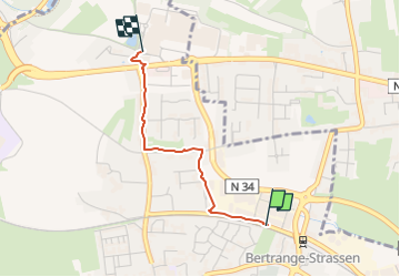

Longueur
1,8 km

Altitude max
327 m

Dénivelé positif
36 m
Km-Effort
2,2 km

Altitude min
291 m

Dénivelé négatif
2 m
Boucle
Non
Date de création :
2023-01-13 09:00:36.591
Dernière modification :
2023-01-20 07:13:31.547
20m
Difficulté : Facile

Application GPS de randonnée GRATUITE
 SityTrail
IGN / Instituts géographiques
SityTrail Plus
Le monde est à vous
À propos
Randonnée Marche de 1,8 km à découvrir à Inconnu, Canton Luxembourg, Bertrange. Cette randonnée est proposée par fra_depoorter.
Localisation
Pays :
Luxembourg
Région :
Inconnu
Département/Province :
Canton Luxembourg
Commune :
Bertrange
Localité :
Unknown
Départ:(Dec)
Départ:(UTM)
287460 ; 5499850 (32U) N.
Commentaires