![](/images/other/stat-length.png)
![Randonnée Marche Lampaul-Plouarzel - Lanildut 01 juillet 23 - Photo](https://media.geolcdn.com/t/1900/400/ext.pjpeg?maxdim=2&url=https%3A%2F%2Fstatic1.geolcdn.com%2Fsiteimages%2Fupload%2Ffiles%2F1553511878bg_sport_marche.png)
Lanildut 01 juillet 23
joelclaudel
Utilisateur
![Longueur](/images/other/stat-length.png)
Longueur
14,7 km
![Altitude max](https://static1.geolcdn.com/siteimages/upload/files/1508320355ic_sort_altitude_max_24dp.png)
Altitude max
30 m
![Dénivelé positif](https://static1.geolcdn.com/siteimages/upload/files/1508320355ic_sort_den_pos_24dp.png)
Dénivelé positif
162 m
![Km-Effort](/images/other/stat-length.png)
Km-Effort
16,8 km
![Altitude min](https://static1.geolcdn.com/siteimages/upload/files/1508320355ic_sort_altitude_min_24dp.png)
Altitude min
1 m
![Dénivelé négatif](https://static1.geolcdn.com/siteimages/upload/files/1508320355ic_sort_den_neg_24dp.png)
Dénivelé négatif
159 m
![Boucle](https://static1.geolcdn.com/siteimages/upload/files/16400158638029165_repeat_loop_refresh_sync_direction_icon.png)
Boucle
Non
Date de création :
2023-07-01 08:24:40.79
Dernière modification :
2023-07-01 14:06:20.929
![Marche](https://static1.geolcdn.com/sitytour/trail-icons/101.png)
3h49
Difficulté : Difficile
![Scannez ce code QR pour ouvrir la randonnée dans l'application SityTrail](https://capi.geolives.com/qq0zvz2zws4bq2lad0pu/sitytour/trails/3718711/qr.png?size=200)
Application GPS de randonnée GRATUITE
À propos
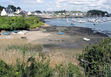
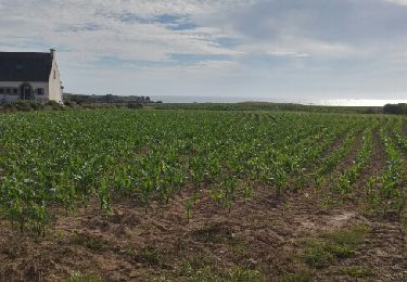
Randonnée Marche de 14,7 km à découvrir à Bretagne, Finistère, Lampaul-Plouarzel. Cette randonnée est proposée par joelclaudel.
Description
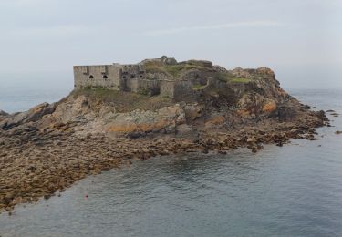
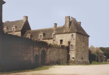
Circuit n° 26 guide FFRP Le Pays d'Iroise à pied
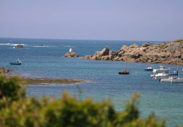
Au fil de l'aber Ilnut
Traversée de l'aber en barque (office du tourisme
Localisation
Pays :
France
Région :
Bretagne
Département/Province :
Finistère
Commune :
Lampaul-Plouarzel
Localité :
Unknown
Départ:(Dec)
Départ:(UTM)
370079 ; 5369832 (30U) N.
Commentaires
Randonnées à proximité
![Randonnée Marche Lanildut - Autour de Lanildut - Photo](https://media.geolcdn.com/t/375/260/ext.jpg?maxdim=2&url=https%3A%2F%2Fservices.sitytrail.com%2FGeolivesWS%2FDownloadMedia.ashx%3FTrailID%3D112681%26Media%3D11473_5.jpg)
![Marche Marche](https://static1.geolcdn.com/sitytour/trail-icons/101.png)
Autour de Lanildut
Marche
Facile
(2)
Lanildut,
Bretagne,
Finistère,
France
![](/images/other/stat-length.png)
7 km | 8 km-effort
1h 45min
![](https://static1.geolcdn.com/siteimages/upload/files/16400158638029165_repeat_loop_refresh_sync_direction_icon.png)
Oui
![Randonnée Marche Lampaul-Plouarzel - 09.09.23 Lampaul- Plouarzel -- Le Conquet - Photo](https://media.geolcdn.com/t/375/260/ext.jpg?maxdim=2&url=https%3A%2F%2Fmedia.geolcdn.com%2Ff%2F888d86e8-0fc8-4dcf-a126-61bf014bddca.jpg)
![Marche Marche](https://static1.geolcdn.com/sitytour/trail-icons/101.png)
09.09.23 Lampaul- Plouarzel -- Le Conquet
Marche
Très difficile
Lampaul-Plouarzel,
Bretagne,
Finistère,
France
![](/images/other/stat-length.png)
21 km | 26 km-effort
5h 49min
![](https://static1.geolcdn.com/siteimages/upload/files/16400158638029165_repeat_loop_refresh_sync_direction_icon.png)
Non
![Randonnée Marche Lampaul-Plouarzel - Lanpaul - Lochrist - Photo](https://media.geolcdn.com/t/375/260/ext.jpg?maxdim=2&url=https%3A%2F%2Fmedia.geolcdn.com%2Ff%2Fef6f4209-61ed-4c81-8584-8b20cf3e3c1d.jpg)
![Marche Marche](https://static1.geolcdn.com/sitytour/trail-icons/101.png)
Lanpaul - Lochrist
Marche
Moyen
Lampaul-Plouarzel,
Bretagne,
Finistère,
France
![](/images/other/stat-length.png)
19,8 km | 24 km-effort
5h 7min
![](https://static1.geolcdn.com/siteimages/upload/files/16400158638029165_repeat_loop_refresh_sync_direction_icon.png)
Non
![Randonnée Marche nordique Porspoder - porspoder - Photo](https://media.geolcdn.com/t/375/260/ext.jpg?maxdim=2&url=https%3A%2F%2Fmedia.geolcdn.com%2Ff%2Fca08756e-88ee-4f60-a720-df9bbcb94795.jpg)
![Marche nordique Marche nordique](https://static1.geolcdn.com/sitytour/trail-icons/102.png)
porspoder
Marche nordique
Très facile
Porspoder,
Bretagne,
Finistère,
France
![](/images/other/stat-length.png)
13,2 km | 14,4 km-effort
3h 13min
![](https://static1.geolcdn.com/siteimages/upload/files/16400158638029165_repeat_loop_refresh_sync_direction_icon.png)
Oui
![Randonnée Marche Lanildut - Aber Ildut - Tremazan - Photo](https://media.geolcdn.com/t/375/260/ext.jpg?maxdim=2&url=https%3A%2F%2Fservices.sitytrail.com%2FGeolivesWS%2FDownloadMedia.ashx%3FTrailID%3D968872%26Media%3Dfix__20180518160311.jpg)
![Marche Marche](https://static1.geolcdn.com/sitytour/trail-icons/101.png)
Aber Ildut - Tremazan
Marche
Facile
Lanildut,
Bretagne,
Finistère,
France
![](/images/other/stat-length.png)
19,5 km | 22 km-effort
4h 42min
![](https://static1.geolcdn.com/siteimages/upload/files/16400158638029165_repeat_loop_refresh_sync_direction_icon.png)
Non
![Randonnée Marche Porspoder - Circuit de la pointe Garchine par les terres. - Photo](https://media.geolcdn.com/t/375/260/ext.jpg?maxdim=2&url=https%3A%2F%2Fservices.sitytrail.com%2FGeolivesWS%2FDownloadMedia.ashx%3FTrailID%3D791378%26Media%3Dfix__20170717183807.jpg)
![Marche Marche](https://static1.geolcdn.com/sitytour/trail-icons/101.png)
Circuit de la pointe Garchine par les terres.
Marche
Très facile
(1)
Porspoder,
Bretagne,
Finistère,
France
![](/images/other/stat-length.png)
9,3 km | 10,5 km-effort
2h 57min
![](https://static1.geolcdn.com/siteimages/upload/files/16400158638029165_repeat_loop_refresh_sync_direction_icon.png)
Oui
![Randonnée Marche Lanildut - Lanildut Porspoder - Photo](https://media.geolcdn.com/t/375/260/ext.jpg?maxdim=2&url=https%3A%2F%2Fstatic1.geolcdn.com%2Fsiteimages%2Fupload%2Ffiles%2F1553511878bg_sport_marche.png)
![Marche Marche](https://static1.geolcdn.com/sitytour/trail-icons/101.png)
Lanildut Porspoder
Marche
Moyen
(1)
Lanildut,
Bretagne,
Finistère,
France
![](/images/other/stat-length.png)
18,3 km | 21 km-effort
4h 34min
![](https://static1.geolcdn.com/siteimages/upload/files/16400158638029165_repeat_loop_refresh_sync_direction_icon.png)
Oui
![Randonnée Vélo Porspoder - Les Menhirs, circuit n°3 - Photo](https://media.geolcdn.com/t/375/260/ext.jpg?maxdim=2&url=https%3A%2F%2Fservices.sitytrail.com%2FGeolivesWS%2FDownloadMedia.ashx%3FTrailID%3D111411%26Media%3D7159_6.jpg)
![Vélo Vélo](https://static1.geolcdn.com/sitytour/trail-icons/200.png)
Les Menhirs, circuit n°3
Vélo
Moyen
Porspoder,
Bretagne,
Finistère,
France
![](/images/other/stat-length.png)
25 km | 29 km-effort
1h 30min
![](https://static1.geolcdn.com/siteimages/upload/files/16400158638029165_repeat_loop_refresh_sync_direction_icon.png)
Oui
![Randonnée V.T.T. Brélès - Espace VTT FFC du Pays d'Iroise- Circuit n° 12 - Photo](https://media.geolcdn.com/t/375/260/ext.jpg?maxdim=2&url=https%3A%2F%2Fservices.sitytrail.com%2FGeolivesWS%2FDownloadMedia.ashx%3FTrailID%3D100941%26Media%3D440_6.jpg)
![V.T.T. V.T.T.](https://static1.geolcdn.com/sitytour/trail-icons/202.png)
Espace VTT FFC du Pays d'Iroise- Circuit n° 12
V.T.T.
Très difficile
Brélès,
Bretagne,
Finistère,
France
![](/images/other/stat-length.png)
65 km | 73 km-effort
4h 30min
![](https://static1.geolcdn.com/siteimages/upload/files/16400158638029165_repeat_loop_refresh_sync_direction_icon.png)
Oui