


20 km | 28 km-effort

Utilisateur


Application GPS de randonnée GRATUITE
 SityTrail
IGN / Instituts géographiques
SityTrail World
Le monde est à vous
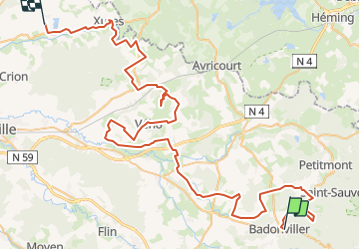
Randonnée Cyclotourisme de 84 km à découvrir à Grand Est, Meurthe-et-Moselle, Badonviller. Cette randonnée est proposée par Regis Chomel.
Départ de Badonviller
La Chapelotte
Nécropole
Blockhaus de Bréménil
de Parux
Casemates de Montreux/Neuviller
(traversée de Saint-Maurice aux-Forges)
Etapes repas/repos Etang sous Launoy à Sainte Pôle
Église reconstruite de Ancerviller (vitraux)
(traversée de Mignéville)
Herbéviller église reconstruite (vitraux)
Chapelle à Saint Martin, dédiée au régiment de
Territoriaux
(traversée de Domèvre)
Hôpital de Domjevin
Etape à la ferme équestre pour permettre de visiter l'après-midi
Manonviller visite du Fort /14/18
2ème jour
Départ de Manonviller
Chapelle de Bonne Fontaine
Monument aux Morts de Vého
Nécropole de Reillon
Entonnoirs de Leintrey
Abri du Kronprinz
Guéoirs de Xousse et Vaucourt
Franchissement du canal à Xures
Camping à la Base de loisirs de Bures
3ème jour
Départ de Bures
Passage au Monument des 3 Américains


Marche
Marche
Marche

Randonnée équestre
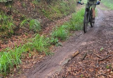
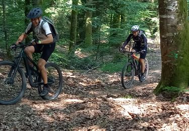
V.T.T.
V.T.T.
Vélo électrique

Trail
Vélo électrique