


sabots de Godefroid

thomas1986
Utilisateur
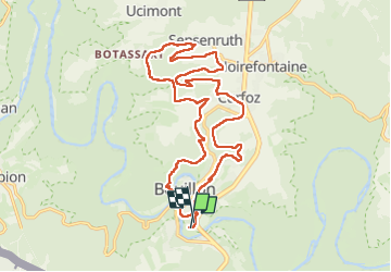

Longueur
19,8 km

Altitude max
394 m

Dénivelé positif
628 m
Km-Effort
28 km

Altitude min
216 m

Dénivelé négatif
606 m
Boucle
Oui
Date de création :
2024-05-01 09:05:24.813
Dernière modification :
2024-05-01 14:11:25.166
4h30
Difficulté : Très difficile

Application GPS de randonnée GRATUITE
 SityTrail
IGN / Instituts géographiques
SityTrail Plus
Le monde est à vous
À propos
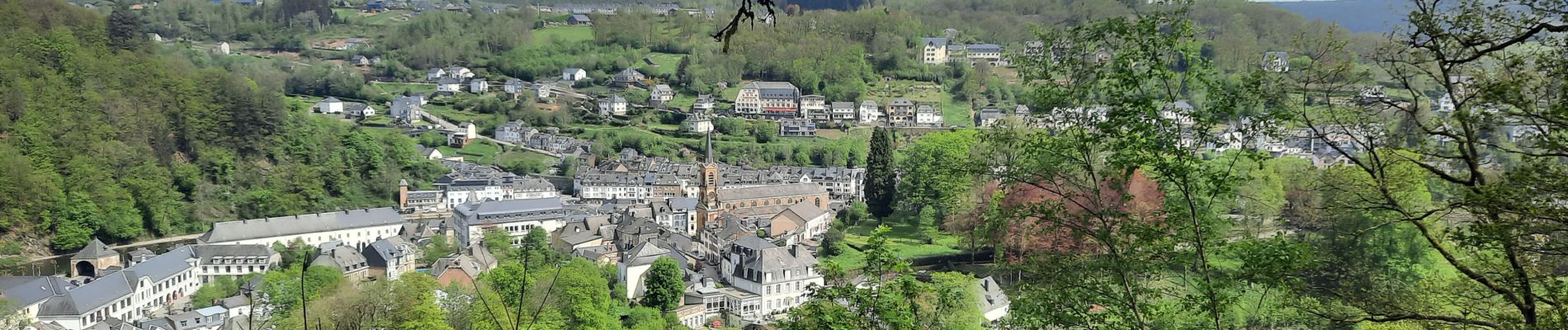
Randonnée Marche de 19,8 km à découvrir à Wallonie, Luxembourg, Bouillon. Cette randonnée est proposée par thomas1986.
Photos


Localisation
Pays :
Belgique
Région :
Wallonie
Département/Province :
Luxembourg
Commune :
Bouillon
Localité :
Unknown
Départ:(Dec)
Départ:(UTM)
648947 ; 5516995 (31U) N.
Commentaires