


traiter Roussis

Dupuybadonniere
Utilisateur
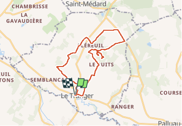

Longueur
15,1 km

Altitude max
178 m

Dénivelé positif
228 m
Km-Effort
18,1 km

Altitude min
93 m

Dénivelé négatif
228 m
Boucle
Oui
Date de création :
2024-07-05 07:39:31.907
Dernière modification :
2024-07-05 13:21:31.067
3h32
Difficulté : Difficile

Application GPS de randonnée GRATUITE
 SityTrail
IGN / Instituts géographiques
SityTrail Plus
Le monde est à vous
À propos
Randonnée Marche de 15,1 km à découvrir à Centre-Val de Loire, Indre, Le Tranger. Cette randonnée est proposée par Dupuybadonniere.
Localisation
Pays :
France
Région :
Centre-Val de Loire
Département/Province :
Indre
Commune :
Le Tranger
Localité :
Unknown
Départ:(Dec)
Départ:(UTM)
366050 ; 5201920 (31T) N.
Commentaires