


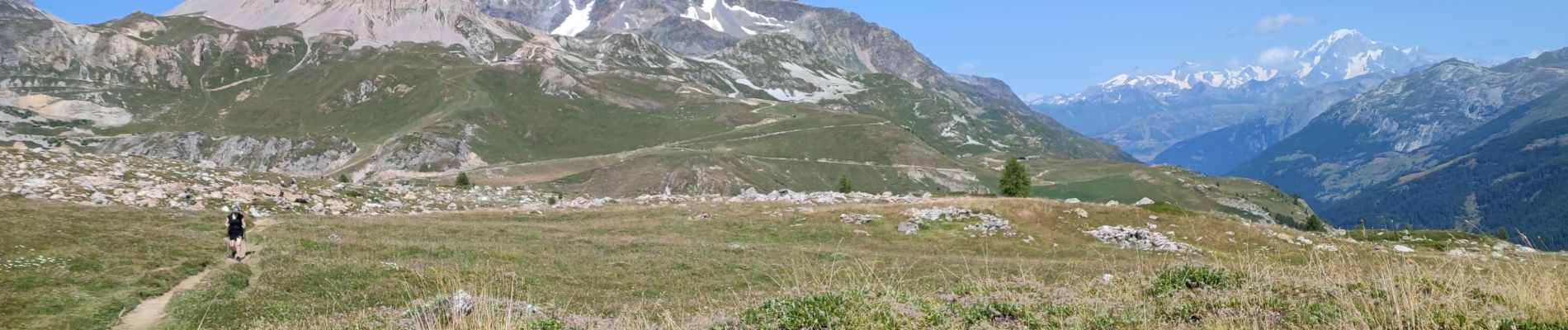
240816 - Tignes - Tignes-CombeFolle

randodan
Utilisateur
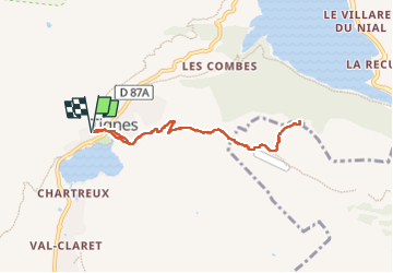

Longueur
7,5 km

Altitude max
2278 m

Dénivelé positif
308 m
Km-Effort
11,6 km

Altitude min
2085 m

Dénivelé négatif
307 m
Boucle
Oui
Date de création :
2024-08-16 07:15:36.432
Dernière modification :
2024-08-16 11:26:05.85
4h09
Difficulté : Moyen

Application GPS de randonnée GRATUITE
 SityTrail
IGN / Instituts géographiques
SityTrail Plus
Le monde est à vous
À propos
Randonnée Marche de 7,5 km à découvrir à Auvergne-Rhône-Alpes, Savoie, Tignes. Cette randonnée est proposée par randodan.
Photos


Localisation
Pays :
France
Région :
Auvergne-Rhône-Alpes
Département/Province :
Savoie
Commune :
Tignes
Localité :
Unknown
Départ:(Dec)
Départ:(UTM)
336178 ; 5037173 (32T) N.
Commentaires