


Warnant

thomarche
Utilisateur
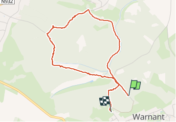

Longueur
4,1 km

Altitude max
235 m

Dénivelé positif
87 m
Km-Effort
5,4 km

Altitude min
151 m

Dénivelé négatif
118 m
Boucle
Non
Date de création :
2024-10-10 12:11:18.0
Dernière modification :
2024-10-10 13:49:33.263
1h37
Difficulté : Facile

Application GPS de randonnée GRATUITE
 SityTrail
IGN / Instituts géographiques
SityTrail Plus
Le monde est à vous
À propos
Randonnée Marche de 4,1 km à découvrir à Wallonie, Namur, Anhée. Cette randonnée est proposée par thomarche.
Description
Chouette petite boucle dans les bois entre Warnant et Bioul.
Localisation
Pays :
Belgique
Région :
Wallonie
Département/Province :
Namur
Commune :
Anhée
Localité :
Unknown
Départ:(Dec)
Départ:(UTM)
630441 ; 5576503 (31U) N.
Commentaires