


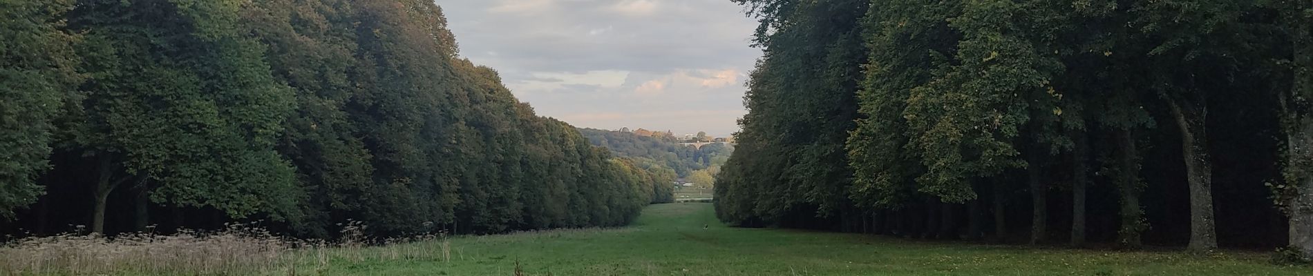
Meudon châtaignes

c.chehere
Utilisateur
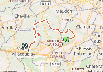

Longueur
12,6 km

Altitude max
186 m

Dénivelé positif
194 m
Km-Effort
15,2 km

Altitude min
112 m

Dénivelé négatif
192 m
Boucle
Non
Date de création :
2024-10-14 06:35:40.808
Dernière modification :
2024-10-14 13:20:45.327
3h27
Difficulté : Facile

Application GPS de randonnée GRATUITE
 SityTrail
IGN / Instituts géographiques
SityTrail Plus
Le monde est à vous
À propos
Randonnée Marche de 12,6 km à découvrir à Île-de-France, Hauts-de-Seine, Clamart. Cette randonnée est proposée par c.chehere.
Photos


Localisation
Pays :
France
Région :
Île-de-France
Département/Province :
Hauts-de-Seine
Commune :
Clamart
Localité :
Unknown
Départ:(Dec)
Départ:(UTM)
443941 ; 5403835 (31U) N.
Commentaires