


Duitsland - 2015-09-10 Schöneseiffen - Perlenbachtalsperre

misph
Utilisateur
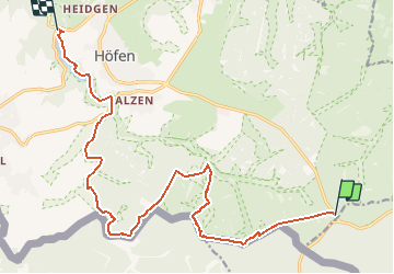

Longueur
15,5 km

Altitude max
634 m

Dénivelé positif
189 m
Km-Effort
18,6 km

Altitude min
454 m

Dénivelé négatif
362 m
Boucle
Non
Date de création :
2017-05-05 00:00:00.0
Dernière modification :
2017-05-05 00:00:00.0
4h02
Difficulté : Facile

Application GPS de randonnée GRATUITE
 SityTrail
IGN / Instituts géographiques
SityTrail Plus
Le monde est à vous
À propos
Randonnée Marche de 15,5 km à découvrir à Rhénanie-du-Nord-Westphalie, Région urbaine d'Aix-la-Chapelle, Montjoie. Cette randonnée est proposée par misph.
Description
Duitsland - 2015-09-10 Schöneseiffen - Perlenbachtalsperre
Localisation
Pays :
Allemagne
Région :
Rhénanie-du-Nord-Westphalie
Département/Province :
Région urbaine d'Aix-la-Chapelle
Commune :
Montjoie
Localité :
Unknown
Départ:(Dec)
Départ:(UTM)
310408 ; 5598014 (32U) N.
Commentaires