


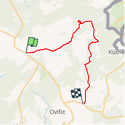
Bar. Michel - Helle - Sourbrodt

GANET
Utilisateur

Longueur
19,8 km

Altitude max
675 m

Dénivelé positif
258 m
Km-Effort
24 km

Altitude min
515 m

Dénivelé négatif
366 m
Boucle
Non
Date de création :
2017-01-22 00:00:00.0
Dernière modification :
2017-01-22 00:00:00.0
5h58
Difficulté : Facile

Application GPS de randonnée GRATUITE
 SityTrail
IGN / Instituts géographiques
SityTrail Plus
Le monde est à vous
À propos
Randonnée Marche de 19,8 km à découvrir à Wallonie, Liège, Jalhay. Cette randonnée est proposée par GANET.
Description
Baraque Michel (bus depuis Verviers) - descente vers la Helle, remontée vers Sourbrodt (bus vers Verviers)
sous la neige , superbe !
Localisation
Pays :
Belgique
Région :
Wallonie
Département/Province :
Liège
Commune :
Jalhay
Localité :
Jalhay
Départ:(Dec)
Départ:(UTM)
291803 ; 5600478 (32U) N.
Commentaires