Randonnée Marche Solutré-Pouilly - La Roche de Solutré (17 km - D. 698 m) - Photo

La Roche de Solutré (17 km - D. 698 m)

 Thomasdanielle
Thomasdanielle

Utilisateur

© OpenStreetMap contributors
Longueur
Longueur
16,9 km
Altitude max
Altitude max
478 m
Dénivelé positif
Dénivelé positif
651 m
Km-Effort
Km-Effort  
26 km
Altitude min
Altitude min
217 m
Dénivelé négatif
Dénivelé négatif
649 m
Boucle
Boucle
Oui
Date de création :
2017-04-18 00:00:00.0
Dernière modification :
2017-04-18 00:00:00.0

(0 Avis)

Marche
Marche
5h19
Difficulté : Moyen

Scannez ce code QR pour ouvrir la randonnée dans l'application SityTrail

Application GPS de randonnée GRATUITE

Logo SityTrail SityTrail

IGN / Instituts géographiques

Télécharger SityTrail sur l'App Store Télécharger SityTrail sur Google Play

Logo SityTrail SityTrail World

Le monde est à vous

Télécharger SityTrail sur l'App Store Télécharger SityTrail sur Google Play Télécharger SityTrail sur Huawei AppGallery

À propos

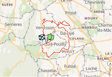
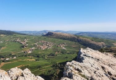
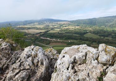
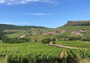
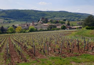
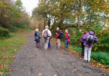
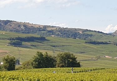
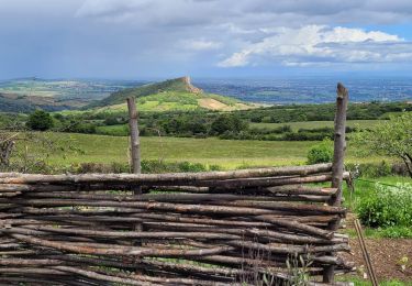
Randonnée Marche de 16,9 km à découvrir à Bourgogne-Franche-Comté, Saône-et-Loire, Solutré-Pouilly. Cette randonnée est proposée par Thomasdanielle.

Description

La Roche de Solutré - Parking Musée de préhistoire

Profil altimétrique

Localisation

Pays :
France
Région :
Bourgogne-Franche-Comté
Département/Province :
Saône-et-Loire
Commune :
Solutré-Pouilly
Localité :
Unknown
Départ:(Dec)
Départ:(UTM)
632311 ; 5128468 (31T) N.

Randonnées à proximité

Randonnée Marche Solutré-Pouilly - Roche de Solutré 4km - Photo
Marche
GUIDE
thonyc

Marche

Facile
(1)
Solutré-Pouilly, Bourgogne-Franche-Comté, Saône-et-Loire, France
3,7 km | 5,5 km-effort
2h 0min
Oui
Randonnée V.T.T. Serrières - RTT 2015 SAMEDI - Photo
V.T.T.
Tollard

V.T.T.

Difficile
(2)
Serrières, Bourgogne-Franche-Comté, Saône-et-Loire, France
66 km | 98 km-effort
6h 7min
Oui
Randonnée Marche Pierreclos - Chateau de Pierreclos - Bourgogne - Aout 2012 - Photo
Marche
patrickmarchais

Marche

Facile
(1)
Pierreclos, Bourgogne-Franche-Comté, Saône-et-Loire, France
18,4 km | 26 km-effort
4h 39min
Oui
Randonnée Marche Solutré-Pouilly - La roche de Solutré  - Photo
Marche
alainjoseph6

Marche

Facile
Solutré-Pouilly, Bourgogne-Franche-Comté, Saône-et-Loire, France
3,4 km | 4,8 km-effort
1h 17min
Oui
Randonnée Marche Davayé - Roche de solutré - Photo
Marche
yves62410

Marche

Difficile
Davayé, Bourgogne-Franche-Comté, Saône-et-Loire, France
10,5 km | 16,5 km-effort
3h 54min
Oui
Randonnée Marche Leynes - LEYNES 71 - Photo
Marche
janussity

Marche

Difficile
Leynes, Bourgogne-Franche-Comté, Saône-et-Loire, France
9,5 km | 12,7 km-effort
2h 38min
Oui
Randonnée Marche Saint-Vérand - St Vérand - Photo
Marche
JPA GRS

Marche

Moyen
(1)
Saint-Vérand, Bourgogne-Franche-Comté, Saône-et-Loire, France
9,8 km | 12,6 km-effort
2h 0min
Oui
Randonnée Marche Vinzelles - Vinzelles - Photo
Marche
janussity

Marche

Facile
(1)
Vinzelles, Bourgogne-Franche-Comté, Saône-et-Loire, France
7,8 km | 10,1 km-effort
2h 6min
Oui
Randonnée Marche Mâcon - Sejour RCY : Les crêtes du Haut Beaujolais journée 1 - Photo
Marche
chessyca

Marche

Très difficile
Mâcon, Bourgogne-Franche-Comté, Saône-et-Loire, France
23 km | 35 km-effort
5h 57min
Non


Fermer
Mes abonnements