


2017 andreenne

olivier26
Utilisateur
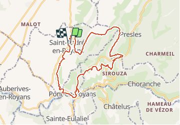

Longueur
19 km

Altitude max
979 m

Dénivelé positif
1035 m
Km-Effort
33 km

Altitude min
195 m

Dénivelé négatif
1037 m
Boucle
Oui
Date de création :
2018-04-17 12:59:41.417
Dernière modification :
2018-04-17 12:59:41.417
--
Difficulté : Difficile

Application GPS de randonnée GRATUITE
 SityTrail
IGN / Instituts géographiques
SityTrail Plus
Le monde est à vous
À propos
Randonnée Marche de 19 km à découvrir à Auvergne-Rhône-Alpes, Isère, Saint-André-en-Royans. Cette randonnée est proposée par olivier26.
Localisation
Pays :
France
Région :
Auvergne-Rhône-Alpes
Département/Province :
Isère
Commune :
Saint-André-en-Royans
Localité :
Unknown
Départ:(Dec)
Départ:(UTM)
684236 ; 4995231 (31T) N.
Commentaires