Randonnée Marche Burnhaupt-le-Bas - GR531 Diefmaten Gildwiller - Photo

GR531 Diefmaten Gildwiller

 helmut68
helmut68

Utilisateur

© OpenStreetMap contributors
Longueur
Longueur
6,1 km
Altitude max
Altitude max
361 m
Dénivelé positif
Dénivelé positif
143 m
Km-Effort
Km-Effort  
7,9 km
Altitude min
Altitude min
289 m
Dénivelé négatif
Dénivelé négatif
102 m
Boucle
Boucle
Non
Date de création :
2018-07-20 19:16:13.213
Dernière modification :
2018-07-20 19:16:13.213

(0 Avis)

Marche
Marche
1h14
Difficulté : Facile

Scannez ce code QR pour ouvrir la randonnée dans l'application SityTrail

Application GPS de randonnée GRATUITE

Logo SityTrail SityTrail

IGN / Instituts géographiques

Télécharger SityTrail sur l'App Store Télécharger SityTrail sur Google Play

Logo SityTrail SityTrail World

Le monde est à vous

Télécharger SityTrail sur l'App Store Télécharger SityTrail sur Google Play Télécharger SityTrail sur Huawei AppGallery

À propos

Randonnée Marche de 6,1 km à découvrir à Grand Est, Haut-Rhin, Burnhaupt-le-Bas. Cette randonnée est proposée par helmut68.

Description

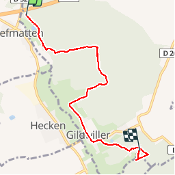
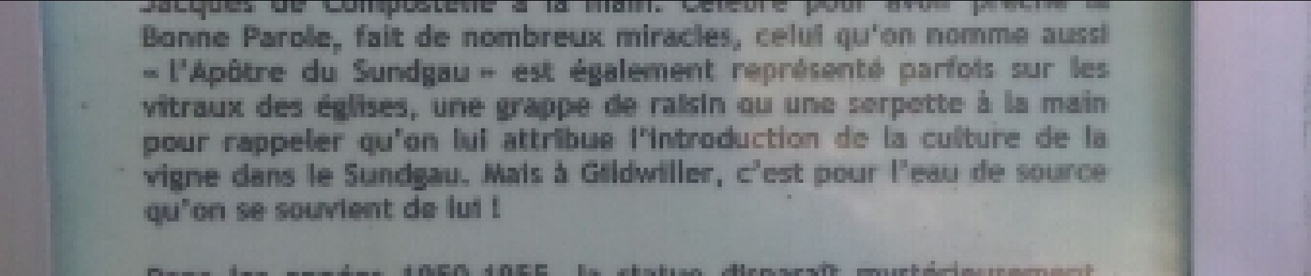
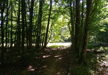
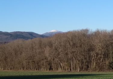
Partie du GR 531, de Diefmaten à Gildwiller, tout se fait sur un chemin à travers forêt, puis après un petite traversée de Gildwiller, on poursuit par le chemin de croix pour arriver au mont de Gildwiller, non loin se trouve la fontaine de St Morand
Prochaine étape Gildwiller Ilfurth...

Profil altimétrique

Photos

Localisation

Pays :
France
Région :
Grand Est
Département/Province :
Haut-Rhin
Commune :
Burnhaupt-le-Bas
Localité :
Unknown
Départ:(Dec)
Départ:(UTM)
358733 ; 5285876 (32T) N.

Randonnées à proximité

Randonnée Marche Sentheim - Sentheim Rossberg - Photo
Marche
helmut68

Marche

Moyen
(1)
Sentheim, Grand Est, Haut-Rhin, France
27 km | 40 km-effort
6h 11min
Oui
Randonnée Marche Sentheim - Knapphutte Saegenkopf Hütte - Photo
Marche
helmut68

Marche

Moyen
Sentheim, Grand Est, Haut-Rhin, France
13,8 km | 17,2 km-effort
5h 11min
Oui
Randonnée Marche Burnhaupt-le-Haut - Rando du 09/02/2024 par Alain...Pont d'Aspach - Photo
Marche
boubou68

Marche

Très difficile
Burnhaupt-le-Haut, Grand Est, Haut-Rhin, France
22 km | 27 km-effort
5h 12min
Oui
Randonnée Marche Sentheim - Montori - Photo
Marche
helmut68

Marche

Moyen
Sentheim, Grand Est, Haut-Rhin, France
17,7 km | 24 km-effort
4h 47min
Oui
Randonnée V.T.T. Sentheim - AperoDioller - Photo
V.T.T.
helmut68

V.T.T.

Facile
Sentheim, Grand Est, Haut-Rhin, France
24 km | 27 km-effort
1h 23min
Oui
Randonnée Marche Sentheim - Baerenkopf  - Photo
Marche
helmut68

Marche

Difficile
Sentheim, Grand Est, Haut-Rhin, France
33 km | 49 km-effort
7h 0min
Oui
Randonnée Marche Sentheim - Sentheim Bellemagny Sentheim  - Photo
Marche
helmut68

Marche

Moyen
Sentheim, Grand Est, Haut-Rhin, France
23 km | 28 km-effort
5h 37min
Oui
Randonnée Marche Sentheim - Buchberg - Rocher du Poilu  - Photo
Marche
helmut68

Marche

Difficile
Sentheim, Grand Est, Haut-Rhin, France
15,3 km | 22 km-effort
3h 45min
Oui
Randonnée Marche Sentheim - SentheimGuew.Sentheim - Photo
Marche
helmut68

Marche

Facile
Sentheim, Grand Est, Haut-Rhin, France
9,6 km | 11 km-effort
2h 15min
Oui


Fermer
Mes abonnements