Trail Walking Guils de Cerdanya - guils refuge Malniu AR - Photo

guils refuge Malniu AR

 jopa
jopa

User

© OpenStreetMap contributors
Length
Length
18.1 km
Max alt
Max alt
2220 m
Uphill gradient
Uphill gradient
946 m
Km-Effort
Km-Effort  
31 km
Min alt
Min alt
1414 m
Downhill gradient
Downhill gradient
946 m
Boucle
Boucle
Yes
Creation date :
2017-05-27 00:00:00.0
Updated on :
2017-05-27 00:00:00.0

(0 Reviews)

Walking
Walking
7h34
Difficulty : Unknown

Scan this QR Code to open this trail in the SityTrail application

FREE GPS app for hiking

Logo SityTrail SityTrail

IGN / Geographical institutes

Download SityTrail from the App Store Download SityTrail from Google Play

Logo SityTrail SityTrail World

The world is yours!

Download SityTrail from the App Store Download SityTrail from Google Play Download SityTrail on Huawei AppGallery

About

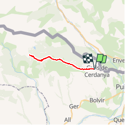
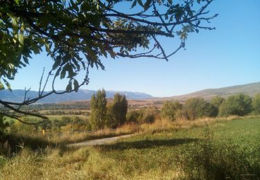
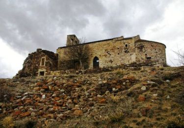
Trail Walking of 18.1 km to be discovered at Catalonia, Girona, Guils de Cerdanya. This trail is proposed by jopa.

Description

Gr11 18km 900m dénivelée... arrivée au pied du Campcardos

Elevation profile

Positioning

Country:
Spain
Region :
Catalonia
Department/Province :
Girona
Municipality :
Guils de Cerdanya
Location:
Unknown
Start:(UTM)
407606 ; 4700327 (31T) N.

Trails nearby

Trail Walking Ur - de Ur vers La Chapelle de Belloc - Photo
Walking
ThonyM

Walking

Easy
(1)
Ur, Occitania, Pyrénées-Orientales, France
20 km | 28 km-effort
7h 14min
Yes
Trail Walking Enveitg - Bena - Photo
Walking
sereton

Walking

Medium
Enveitg, Occitania, Pyrénées-Orientales, France
11.9 km | 21 km-effort
3h 32min
No
Trail Walking Ur - ur - Photo
Walking
Fildesir

Walking

Very easy
Ur, Occitania, Pyrénées-Orientales, France
18.5 km | 26 km-effort
7h 5min
No
Trail Walking Latour-de-Carol - La Tour de Carol - Photo
Walking
sereton

Walking

Easy
Latour-de-Carol, Occitania, Pyrénées-Orientales, France
15.1 km | 22 km-effort
4h 10min
Yes
Trail Walking Ur - nd belloch par ur - Photo
Walking
Patsoo

Walking

Very easy
Ur, Occitania, Pyrénées-Orientales, France
17.4 km | 25 km-effort
4h 59min
Yes
Trail Walking Enveitg - Balade au dessus de Latour de Carol - Photo
Walking
c.chehere

Walking

Medium
Enveitg, Occitania, Pyrénées-Orientales, France
24 km | 32 km-effort
7h 21min
Yes
Trail Walking Enveitg - Santa Maria de Belloc - Photo
Walking
tracegps

Walking

Easy
Enveitg, Occitania, Pyrénées-Orientales, France
5.8 km | 9.4 km-effort
2h 30min
Yes
Trail Walking Latour-de-Carol - Latour-de-Carol, Les Fontanelles - Photo
Walking
rene091957

Walking

Difficult
Latour-de-Carol, Occitania, Pyrénées-Orientales, France
9.6 km | 14.5 km-effort
3h 17min
Yes
Trail Walking Latour-de-Carol - Prat Redon - Chemin du Llavinet - Photo
Walking
rene091957

Walking

Very difficult
Latour-de-Carol, Occitania, Pyrénées-Orientales, France
16.4 km | 25 km-effort
5h 42min
Yes


Close
My subscriptions