


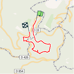

5.9 km | 8.5 km-effort

User


FREE GPS app for hiking
 SityTrail
IGN / Geographical institutes
SityTrail World
The world is yours!
Trail Walking of 4.9 km to be discovered at Grand Est, Bas-Rhin, Ottrott. This trail is proposed by VacheKiri67.
Faite le 11/06/2017 avec notre fils Théo de 12 ans. D'après "Passion Vosges - Autour du Mont Sainte-Odile" N°02 Le circuit nord du Mur Païen. Durée indiquée pour le circuit : 2 heures 30.
Balisage : chevalet jaune.
Ce circuit a été précédé avec "Le circuit nord du Mur Païen".


Walking

Walking

Walking

Walking

Walking

Mountain bike

Mountain bike

Walking

Walking
Balade sympathique sans aucune difficulté
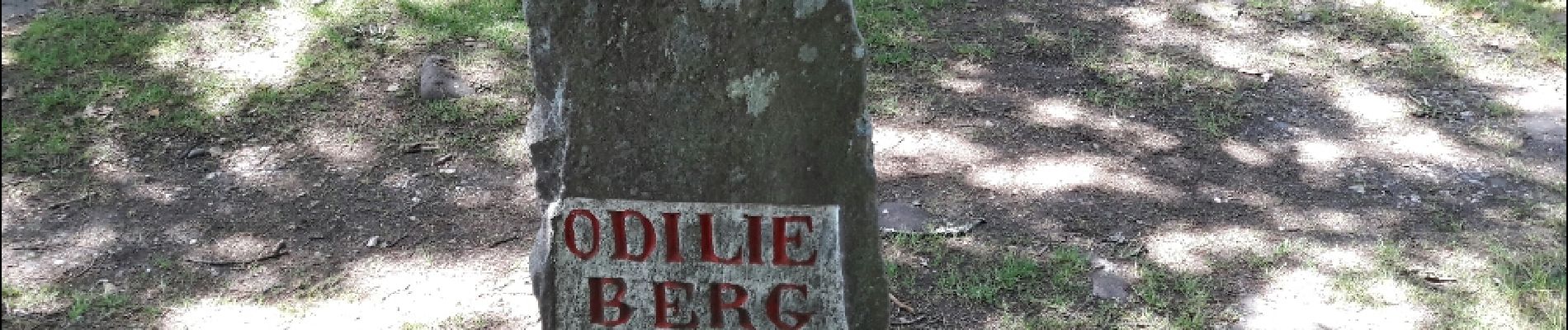
A enchaîner avec le circuit nord du mur païen. Haut lieux d'énergie.