Trail Walking Lamanère - Lamanere_PuigDeComaNegra_T - Photo

Lamanere_PuigDeComaNegra_T

 force
force

User

© OpenStreetMap contributors
Length
Length
15.9 km
Max alt
Max alt
1545 m
Uphill gradient
Uphill gradient
909 m
Km-Effort
Km-Effort  
28 km
Min alt
Min alt
774 m
Downhill gradient
Downhill gradient
904 m
Boucle
Boucle
Yes
Creation date :
2017-07-13 00:00:00.0
Updated on :
2017-07-13 00:00:00.0

(1 Reviews)

Walking
Walking
5h48
Difficulty : Unknown

Scan this QR Code to open this trail in the SityTrail application

FREE GPS app for hiking

Logo SityTrail SityTrail

IGN / Geographical institutes

Download SityTrail from the App Store Download SityTrail from Google Play

Logo SityTrail SityTrail World

The world is yours!

Download SityTrail from the App Store Download SityTrail from Google Play Download SityTrail on Huawei AppGallery

About

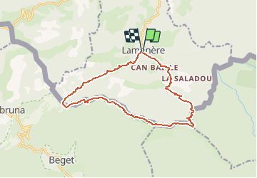
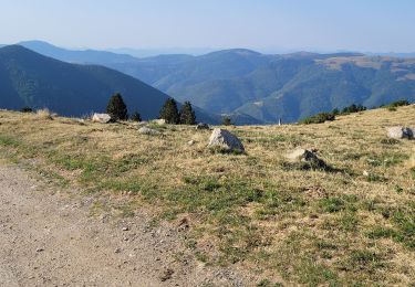
Trail Walking of 15.9 km to be discovered at Occitania, Pyrénées-Orientales, Lamanère. This trail is proposed by force.

Description

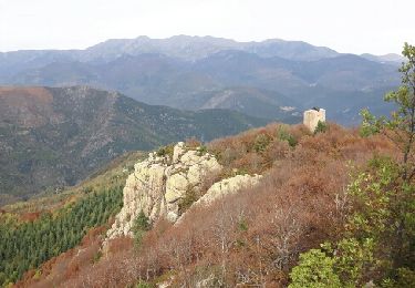
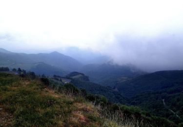
Randonnée mal balisée à partir de la frontière Fr-Es. Vue panoramique au Puig de coma Negra.

Elevation profile

Photos

Points of interest

Point of interest Lamanère - Chapelle Ste Christine - Photo
force

Positioning

Country:
France
Region :
Occitania
Department/Province :
Pyrénées-Orientales
Municipality :
Lamanère
Location:
Unknown
Start:(UTM)
460441 ; 4689817 (31T) N.

Comments

Please log in to post a review or rate the element


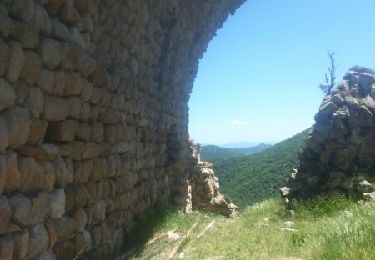
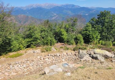
ce circuit suit la frontière


Trails nearby

Trail Walking Lamanère - lamanere-coral_T - Photo
Walking
force

Walking

Very easy
Lamanère, Occitania, Pyrénées-Orientales, France
14.9 km | 25 km-effort
5h 18min
Yes
Trail Walking Lamanère - Tours de Cabrens - Photo
Walking
jcmartin

Walking

Medium
Lamanère, Occitania, Pyrénées-Orientales, France
12 km | 19.6 km-effort
4h 14min
Yes
Trail Walking Serralongue - serralongue Tours de Cabrens_T - Photo
Walking
force

Walking

Medium
Serralongue, Occitania, Pyrénées-Orientales, France
13.3 km | 22 km-effort
4h 39min
Yes
Trail Walking Prats-de-Mollo-la-Preste - 5 et 6 rando sur 2 jours  - Photo
Walking
ricou1964

Walking

Very difficult
Prats-de-Mollo-la-Preste, Occitania, Pyrénées-Orientales, France
32 km | 49 km-effort
9h 39min
Yes
Trail Walking Lamanère - Lamanere - Photo
Walking
jcmartin

Walking

Medium
Lamanère, Occitania, Pyrénées-Orientales, France
16.4 km | 26 km-effort
5h 20min
Yes
Trail Mountain bike Prats-de-Mollo-la-Preste - Espace VTT FFC Haut Vallespir - circuit n° 17 - Raid Transfrontalier - Photo
Mountain bike
tracegps

Mountain bike

Very difficult
Prats-de-Mollo-la-Preste, Occitania, Pyrénées-Orientales, France
41 km | 64 km-effort
4h 30min
Yes
Trail Mountain bike Serralongue - Espace VTT FFC Haut Vallespir - circuit n° 11 - De Serralongue à Falgos - Photo
Mountain bike
tracegps

Mountain bike

Difficult
Serralongue, Occitania, Pyrénées-Orientales, France
28 km | 39 km-effort
2h 30min
Yes
Trail Mountain bike Prats-de-Mollo-la-Preste - Espace VTT FFC Haut Vallespir - circuit n° 3 - La Chapelle Ste Marguerite de Prats de Mollo - Photo
Mountain bike
tracegps

Mountain bike

Easy
Prats-de-Mollo-la-Preste, Occitania, Pyrénées-Orientales, France
12.6 km | 17 km-effort
1h 15min
Yes
Trail Walking Lamanère - 2 - Photo
Walking
ricou1964

Walking

Difficult
Lamanère, Occitania, Pyrénées-Orientales, France
16.7 km | 27 km-effort
5h 2min
Yes


Close
My subscriptions