Trail Walking Allos - le mont Pelat et le lac du trou de l'aigle - Photo

le mont Pelat et le lac du trou de l'aigle

 amiral13
amiral13

User GUIDE

© OpenStreetMap contributors
Length
Length
14.4 km
Max alt
Max alt
3013 m
Uphill gradient
Uphill gradient
941 m
Km-Effort
Km-Effort  
27 km
Min alt
Min alt
2113 m
Downhill gradient
Downhill gradient
941 m
Boucle
Boucle
Yes
Creation date :
2017-07-19 00:00:00.0
Updated on :
2017-07-19 00:00:00.0

(0 Reviews)

Walking
Walking
7h19
Difficulty : Medium

Scan this QR Code to open this trail in the SityTrail application

FREE GPS app for hiking

Logo SityTrail SityTrail

IGN / Geographical institutes

Download SityTrail from the App Store Download SityTrail from Google Play

Logo SityTrail SityTrail World

The world is yours!

Download SityTrail from the App Store Download SityTrail from Google Play Download SityTrail on Huawei AppGallery

About

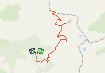
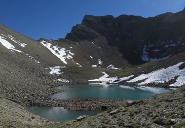
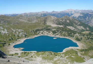
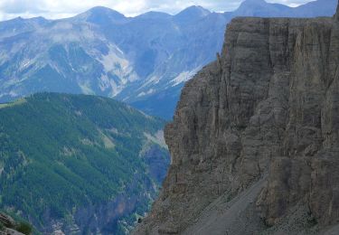
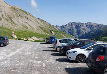
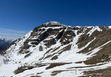
Trail Walking of 14.4 km to be discovered at Provence-Alpes-Côte d'Azur, Alpes-de-Haute-Provence, Allos. This trail is proposed by amiral13.

Description

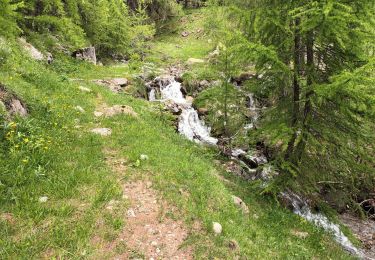
Une randonnée avecune dénivelée importante mais sur un sentier très correct, sauf pour les quelques derniers mètres.
Quelques passages aériens.
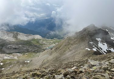
Attention en début de saisons la présence de névés peut rendre les choses plus compliquées et dangereuses.

le temps peut largement être réduit car nous avons pris le temps avec une fillette de 9 ans.

Elevation profile

Photos

Points of interest

Point of interest Allos - marmottes - Photo
amiral13
ALLOS 

Positioning

Country:
France
Region :
Provence-Alpes-Côte d'Azur
Department/Province :
Alpes-de-Haute-Provence
Municipality :
Allos
Location:
Unknown
Start:(UTM)
316175 ; 4901663 (32T) N.

Trails nearby

Trail Walking Uvernet-Fours - Mercantour Le Cimet 3020 m - Photo
Walking
pascalspr

Walking

Medium
(2)
Uvernet-Fours, Provence-Alpes-Côte d'Azur, Alpes-de-Haute-Provence, France
20 km | 34 km-effort
5h 49min
Yes
Trail Walking Uvernet-Fours - Mont Pelat par la grande barre - Photo
Walking
Gouze13

Walking

Difficult
(1)
Uvernet-Fours, Provence-Alpes-Côte d'Azur, Alpes-de-Haute-Provence, France
16.4 km | 34 km-effort
4h 0min
Yes
Trail On foot Entraunes - Circuit des Lacs - Photo
On foot
PRO

On foot

Easy
Entraunes, Provence-Alpes-Côte d'Azur, Maritime Alps, France
8.9 km | 14.7 km-effort
3h 21min
Yes
Trail On foot Entraunes - Col de la Boucharde - Photo
On foot
PRO

On foot

Medium
Entraunes, Provence-Alpes-Côte d'Azur, Maritime Alps, France
16.6 km | 29 km-effort
6h 33min
Yes
Trail On foot Entraunes - Tête de la Boulière - Photo
On foot
PRO

On foot

Medium
Entraunes, Provence-Alpes-Côte d'Azur, Maritime Alps, France
16.9 km | 29 km-effort
6h 41min
Yes
Trail Walking Entraunes - Estenc rando 1  - Photo
Walking
Christiancordin

Walking

Medium
Entraunes, Provence-Alpes-Côte d'Azur, Maritime Alps, France
13 km | 21 km-effort
3h 32min
Yes
Trail Walking Uvernet-Fours - LES LACS DE LA CAYOLLE - Photo
Walking
walrou63

Walking

Difficult
Uvernet-Fours, Provence-Alpes-Côte d'Azur, Alpes-de-Haute-Provence, France
9.9 km | 16 km-effort
3h 5min
Yes
Trail Walking Entraunes - La Grande Tour d’Allos par Estenc - Photo
Walking
bozo1970

Walking

Very difficult
Entraunes, Provence-Alpes-Côte d'Azur, Maritime Alps, France
7.2 km | 23 km-effort
8h 20min
Yes
Trail Walking Entraunes - Montagne de l’Avalanche - Photo
Walking
bozo1970

Walking

Very difficult
Entraunes, Provence-Alpes-Côte d'Azur, Maritime Alps, France
8.5 km | 21 km-effort
5h 13min
Yes


Close
My subscriptions