Randonnée Vélo Pont-Sainte-Maxence - AG2017 AU5V - Photo
 gilbertdu60
gilbertdu60

Utilisateur

© OpenStreetMap contributors
Longueur
Longueur
21 km
Altitude max
Altitude max
57 m
Dénivelé positif
Dénivelé positif
168 m
Km-Effort
Km-Effort  
23 km
Altitude min
Altitude min
29 m
Dénivelé négatif
Dénivelé négatif
169 m
Boucle
Boucle
Oui
Date de création :
2017-03-20 00:00:00.0
Dernière modification :
2017-03-20 00:00:00.0

(0 Avis)

Vélo
Vélo
12m
Difficulté : Facile

Scannez ce code QR pour ouvrir la randonnée dans l'application SityTrail

Application GPS de randonnée GRATUITE

Logo SityTrail SityTrail

IGN / Instituts géographiques

Télécharger SityTrail sur l'App Store Télécharger SityTrail sur Google Play

Logo SityTrail SityTrail World

Le monde est à vous

Télécharger SityTrail sur l'App Store Télécharger SityTrail sur Google Play Télécharger SityTrail sur Huawei AppGallery

À propos

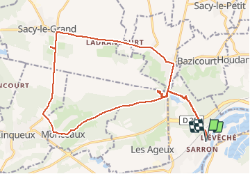
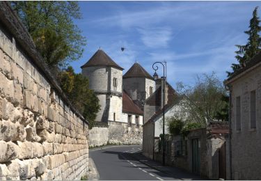
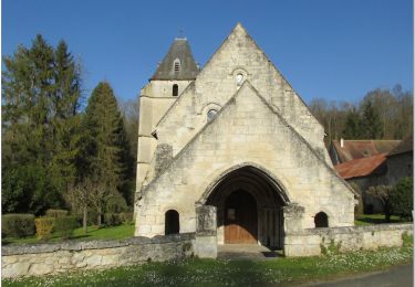
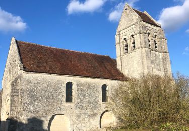
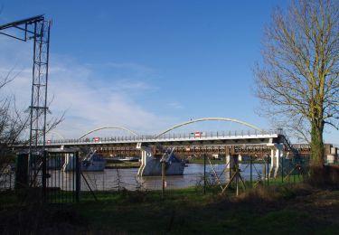
Randonnée Vélo de 21 km à découvrir à Hauts-de-France, Oise, Pont-Sainte-Maxence. Cette randonnée est proposée par gilbertdu60.

Description

Balade aux marais de Sacy le grand et rendez vous avec les buffles

Profil altimétrique

Photos

Points d'intérêt

Point d'intérêt Monceaux - entrée du parc marais de Sacy - Photo
gilbertdu60
Point d'intérêt Monceaux - Belvédère panoramique  - Photo
gilbertdu60

Localisation

Pays :
France
Région :
Hauts-de-France
Département/Province :
Oise
Commune :
Pont-Sainte-Maxence
Localité :
Unknown
Départ:(Dec)
Départ:(UTM)
472555 ; 5462797 (31U) N.

Randonnées à proximité

Randonnée Marche Beaurepaire - La mare aux oiseaux - Beaurepaire - Photo
Marche
tracegps

Marche

Moyen
(1)
Beaurepaire, Hauts-de-France, Oise, France
8,4 km | 10,2 km-effort
2h 10min
Oui
Randonnée A pied Saint-Martin-Longueau - Balade entre Saint-Martin-Longueau et Sacy-le-Petit - Photo
A pied
fitz2014

A pied

Facile
(1)
Saint-Martin-Longueau, Hauts-de-France, Oise, France
13 km | 14,2 km-effort
Inconnu
Oui
Randonnée Marche Pontpoint - Mont Pagnotte Grand parcours - Photo
Marche
CC.RIDER

Marche

Moyen
(2)
Pontpoint, Hauts-de-France, Oise, France
16,6 km | 22 km-effort
4h 36min
Oui
Randonnée V.T.C. Fleurines - randonnée Au5v OT Ccpoh halatte - Photo
V.T.C.
gilbertdu60

V.T.C.

Facile
Fleurines, Hauts-de-France, Oise, France
30 km | 35 km-effort
Inconnu
Oui
Randonnée Cyclotourisme Pont-Sainte-Maxence - sortie AU5v Pentecôte 2022 - Photo
Cyclotourisme
gilbertdu60

Cyclotourisme

Facile
Pont-Sainte-Maxence, Hauts-de-France, Oise, France
26 km | 29 km-effort
Inconnu
Oui
Randonnée A pied Pont-Sainte-Maxence - balade pedestre 11 avril 2022 - Photo
A pied
gilbertdu60

A pied

Facile
Pont-Sainte-Maxence, Hauts-de-France, Oise, France
7,2 km | 9,1 km-effort
2h 4min
Oui
Randonnée Vélo électrique Pont-Sainte-Maxence - balade printanière du 23 mars - Photo
Vélo électrique
gilbertdu60

Vélo électrique

Facile
Pont-Sainte-Maxence, Hauts-de-France, Oise, France
22 km | 26 km-effort
2h 14min
Oui
Randonnée Marche Roberval - Roberval - Photo
Marche
sabrigault

Marche

Moyen
Roberval, Hauts-de-France, Oise, France
7,6 km | 9,5 km-effort
2h 19min
Oui
Randonnée Vélo électrique Pont-Sainte-Maxence - sortie 18 janvier 22 - Photo
Vélo électrique
gilbertdu60

Vélo électrique

Facile
Pont-Sainte-Maxence, Hauts-de-France, Oise, France
23 km | 27 km-effort
2h 4min
Oui


Fermer
Mes abonnements