Le Buisson, Lozère: Top van de beste wandelroutes, trajecten, tochten en wandelingen

Le Buisson: Ontdek de beste tochten: 15 te voet en 2 met de fiets of mountainbike. Al deze tochten, trajecten, routes en outdoor activiteiten zijn beschikbaar in onze SityTrail-apps voor smartphones en tablets.


De beste trajecten (17)
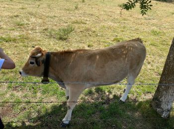
Tocht Stappen Le Buisson - Randonnée du moulinet  - Photo
Stappen 9.315
Km

Stappen

Medium
Le Buisson, Occitanië, Lozère, France
9,3 km | 11,9 km-effort
2h 56min
192 m
193 m
Ja
nicolasdresse

Tocht Stappen Le Buisson - Gite de Sagnebesse - loups du Gevaudan - Photo
Stappen 8.107
Km

Stappen

Heel gemakkelijk
Le Buisson, Occitanië, Lozère, France
8,1 km | 9,8 km-effort
2h 29min
127 m
127 m
Ja
vertygo

Tocht Stappen Le Buisson - Gite de Sagnebesse -  loups du Gevaudan - Sainte Luce - Photo
Stappen 9.87
Km

Stappen

Heel gemakkelijk
Le Buisson, Occitanië, Lozère, France
9,9 km | 12,5 km-effort
3h 3min
194 m
195 m
Ja
vertygo

Tocht Stappen Le Buisson - Randoguide - Photo
Stappen 8.394
Km

Stappen

Heel gemakkelijk
Le Buisson, Occitanië, Lozère, France
8,4 km | 10,9 km-effort
Onbekend
199 m
157 m
Neen
danielbarcelo

Tocht Stappen Le Buisson - LacDuMoulinet - Photo
Stappen 11.048
Km

Stappen

Moeilijk
Le Buisson, Occitanië, Lozère, France
11 km | 14 km-effort
3h 10min
220 m
219 m
Ja
raymondfn

Tocht Stappen Le Buisson - Lac du Moulinet  Chateau de la Beaume - Photo
Stappen 17.542
Km

Stappen

Gemakkelijk
Le Buisson, Occitanië, Lozère, France
17,5 km | 22 km-effort
5h 4min
357 m
362 m
Ja
Alain28/01

Tocht Stappen Le Buisson - Lac du Moiulinet 2 - Photo
Stappen 32.593
Km

Stappen

Zeer moeilijk
Le Buisson, Occitanië, Lozère, France
33 km | 42 km-effort
9h 35min
721 m
721 m
Ja
guitounette

Tocht Stappen Le Buisson - Aubrac 2023 - 4 - Le Gilbertès - Prinsuéjols  - Photo
Stappen 18.702
Km

Stappen

Zeer moeilijk
Le Buisson, Occitanië, Lozère, France
18,7 km | 23 km-effort
5h 2min
351 m
314 m
Neen
jmp76700

Tocht Stappen Le Buisson - moulinet sud - Photo
Stappen 6.03
Km

Stappen

Heel gemakkelijk
Le Buisson, Occitanië, Lozère, France
6 km | 7,4 km-effort
1h 55min
103 m
99 m
Ja
vertygo

Tocht Mountainbike Le Buisson - LE MOULINET 32KM VTT SLDM - Photo
Mountainbike 32.164
Km

Mountainbike

Gemakkelijk
Le Buisson, Occitanië, Lozère, France
32 km | 42 km-effort
2h 16min
755 m
751 m
Ja
benoit48

Tocht Mountainbike Le Buisson - LE BUISSON 28 km VTT Pratbinal - Photo
Mountainbike 27.673
Km

Mountainbike

Heel gemakkelijk
Le Buisson, Occitanië, Lozère, France
28 km | 38 km-effort
2h 23min
738 m
746 m
Ja
benoit48

Tocht Stappen Le Buisson - Tour de l'Aubrac Etape2 - Photo
Stappen 19.552
Km

Stappen

Medium
Le Buisson, Occitanië, Lozère, France
19,6 km | 27 km-effort
5h 48min
590 m
420 m
Neen
rafa77

Tocht Stappen Le Buisson - Randoguide - Photo
Stappen 21.28
Km

Stappen

Gemakkelijk
Le Buisson, Occitanië, Lozère, France
21 km | 26 km-effort
Onbekend
336 m
446 m
Neen
danielbarcelo

Tocht Stappen Le Buisson - Randoguide - Photo
Stappen 21.283
Km

Stappen

Heel gemakkelijk
Le Buisson, Occitanië, Lozère, France
21 km | 26 km-effort
Onbekend
335 m
445 m
Neen
danielbarcelo

Tocht Stappen Le Buisson - Tout du Lac du moulinet  - Photo
Stappen 2.066
Km

Stappen

Le Buisson, Occitanië, Lozère, France
2,1 km | 2,4 km-effort
43min
25 m
34 m
Ja
nicolasdresse

Tocht Stappen Le Buisson - lac du moulinet - Photo
Stappen 2.2
Km

Stappen

Heel gemakkelijk
Le Buisson, Occitanië, Lozère, France
2,2 km | 2,5 km-effort
2h 8min
24 m
26 m
Ja
ALSENYO

Tocht Stappen Le Buisson - 14/05/24 - Photo
Stappen 16.91
Km

Stappen

Medium
Le Buisson, Occitanië, Lozère, France
16,9 km | 21 km-effort
3h 39min
323 m
324 m
Ja
Alain28/01

17 tochten weergegeven op 17

Gratisgps-wandelapplicatie

Logo SityTrail SityTrail

IGN / Geografische instituten

SityTrail uit de App Store downloaden SityTrail uit Google Play downloaden

Logo SityTrail SityTrail World

De wereld gaat voor u open

SityTrail uit de App Store downloaden SityTrail uit Google Play downloaden SityTrail op Huawei AppGallery downloaden

Activiteiten

Sluiten
Mijn abonnementen