


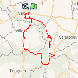
Venon par le circuit de l'arboretum

MichelRando7656
Gebruiker

Lengte
17,2 km

Max. hoogte
156 m

Positief hoogteverschil
198 m
Km-Effort
19,8 km

Min. hoogte
70 m

Negatief hoogteverschil
198 m
Boucle
Ja
Datum van aanmaak :
2019-04-29 10:39:35.375
Laatste wijziging :
2019-04-29 10:39:35.575
4h07
Moeilijkheid : Medium

Gratisgps-wandelapplicatie
 SityTrail
IGN / Geografische instituten
SityTrail Plus
De wereld gaat voor u open
Over ons
Tocht Stappen van 17,2 km beschikbaar op Normandië, Eure, Venon. Deze tocht wordt voorgesteld door MichelRando7656.
Beschrijving
Chemins de campagne, chemins forestiers et quelques tronçons de petites routes. Bonne fraîcheur sous les frondaisons.
Foto's


Plaatsbepaling
Land:
France
Regio :
Normandië
Departement/Provincie :
Eure
Gemeente :
Venon
Locatie:
Unknown
Vertrek:(Dec)
Vertrek:(UTM)
357941 ; 5448485 (31U) N.
Opmerkingen