


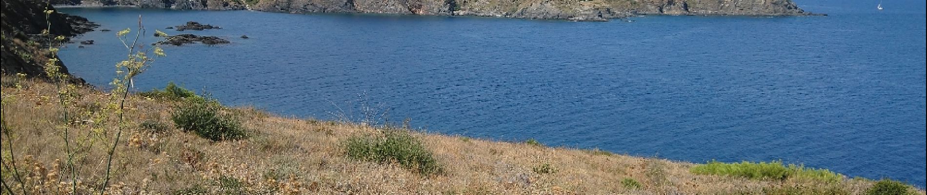
Les Aloès, la frontière Espagnole.

Gegetop
Gebruiker

Lengte
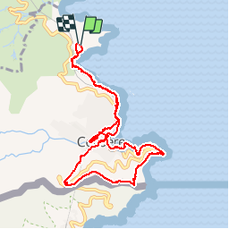
10,8 km

Max. hoogte
179 m

Positief hoogteverschil
371 m
Km-Effort
15,8 km

Min. hoogte
0 m

Negatief hoogteverschil
366 m
Boucle
Ja
Datum van aanmaak :
2019-01-15 16:48:56.036
Laatste wijziging :
2019-01-15 16:48:56.036
3h58
Moeilijkheid : Onbekend

Gratisgps-wandelapplicatie
 SityTrail
IGN / Geografische instituten
SityTrail Plus
De wereld gaat voor u open
Over ons
Tocht Noords wandelen van 10,8 km beschikbaar op Occitanië, Pyrénées-Orientales, Cerbère. Deze tocht wordt voorgesteld door Gegetop.
Beschrijving
AR
Foto's


Plaatsbepaling
Land:
France
Regio :
Occitanië
Departement/Provincie :
Pyrénées-Orientales
Gemeente :
Cerbère
Locatie:
Unknown
Vertrek:(Dec)
Vertrek:(UTM)
513209 ; 4700313 (31T) N.
Opmerkingen