![](/images/other/stat-length.png)
![Tocht Fiets Duinkerke - Autour de Dunkerque - Photo](https://media.geolcdn.com/t/1900/400/ext.pjpeg?maxdim=2&url=https%3A%2F%2Fservices.sitytrail.com%2FGeolivesWS%2FDownloadMedia.ashx%3FTrailID%3D107002%26Media%3D11796_6.jpg)
Autour de Dunkerque
tracegps
Gebruiker
![Lengte](/images/other/stat-length.png)
Lengte
57 km
![Max. hoogte](https://static1.geolcdn.com/siteimages/upload/files/1508320355ic_sort_altitude_max_24dp.png)
Max. hoogte
18 m
![Positief hoogteverschil](https://static1.geolcdn.com/siteimages/upload/files/1508320355ic_sort_den_pos_24dp.png)
Positief hoogteverschil
193 m
![Km-Effort](/images/other/stat-length.png)
Km-Effort
60 km
![Min. hoogte](https://static1.geolcdn.com/siteimages/upload/files/1508320355ic_sort_altitude_min_24dp.png)
Min. hoogte
-3 m
![Negatief hoogteverschil](https://static1.geolcdn.com/siteimages/upload/files/1508320355ic_sort_den_neg_24dp.png)
Negatief hoogteverschil
193 m
![Boucle](https://static1.geolcdn.com/siteimages/upload/files/16400158638029165_repeat_loop_refresh_sync_direction_icon.png)
Boucle
Ja
Datum van aanmaak :
2014-12-10 00:00:00.0
Laatste wijziging :
2014-12-10 00:00:00.0
![Fiets](https://static1.geolcdn.com/sitytour/trail-icons/200.png)
3h00
Moeilijkheid : Medium
![Scan deze QR-code om de tocht te openen in de SityTrail-applicatie](https://capi.geolives.com/qq0zvz2zws4bq2lad0pu/sitytour/trails/107002/qr.png?size=200)
Gratisgps-wandelapplicatie
Over ons
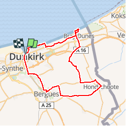
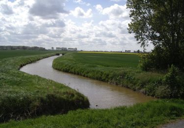
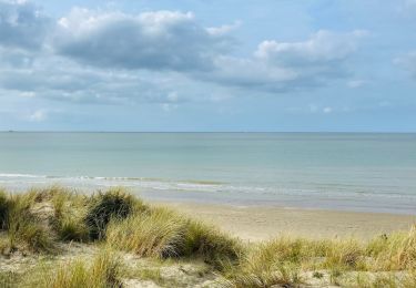
Tocht Fiets van 57 km beschikbaar op Hauts-de-France, Noorderdepartement, Duinkerke. Deze tocht wordt voorgesteld door tracegps.
Beschrijving
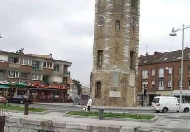
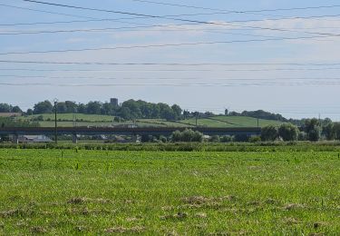
Circuit proposé par le guide du «Petit futé, édition 2007» Départ du quai des hollandais à Dunkerque. Retrouvez le circuit et son descriptif dans le guide 2007 du Petit Futé.
Plaatsbepaling
Land:
France
Regio :
Hauts-de-France
Departement/Provincie :
Noorderdepartement
Gemeente :
Duinkerke
Locatie:
Duinkerke
Vertrek:(Dec)
Vertrek:(UTM)
456207 ; 5654273 (31U) N.
Opmerkingen
Wandeltochten in de omgeving
![Tocht Stappen Duinkerke - Parcours d'architecture - Malo les Bains - Photo](https://media.geolcdn.com/t/375/260/ext.jpg?maxdim=2&url=https%3A%2F%2Fservices.sitytrail.com%2FGeolivesWS%2FDownloadMedia.ashx%3FTrailID%3D105238%26Media%3D8888_6.jpg)
![Stappen Stappen](https://static1.geolcdn.com/sitytour/trail-icons/101.png)
Parcours d'architecture - Malo les Bains
Stappen
Gemakkelijk
(2)
Duinkerke,
Hauts-de-France,
Noorderdepartement,
France
![](/images/other/stat-length.png)
6 km | 6,4 km-effort
1h 30min
![](https://static1.geolcdn.com/siteimages/upload/files/16400158638029165_repeat_loop_refresh_sync_direction_icon.png)
Ja
![Tocht Wegfiets Duinkerke - Dunkerque-frontière belge - Photo](https://media.geolcdn.com/t/375/260/ext.jpg?maxdim=2&url=https%3A%2F%2Fmedia.geolcdn.com%2Ff%2F2487dd4c-e2d7-43d3-a0c9-e180786a9c0b.jpg)
![Wegfiets Wegfiets](https://static1.geolcdn.com/sitytour/trail-icons/201.png)
Dunkerque-frontière belge
Wegfiets
Gemakkelijk
Duinkerke,
Hauts-de-France,
Noorderdepartement,
France
![](/images/other/stat-length.png)
31 km | 33 km-effort
3h 4min
![](https://static1.geolcdn.com/siteimages/upload/files/16400158638029165_repeat_loop_refresh_sync_direction_icon.png)
Neen
![Tocht Stappen Nieuw-Koudekerke - Circuit des Forts de Coukerque à Bergues - Coudekerque-Branche - Photo](https://media.geolcdn.com/t/375/260/ext.jpg?maxdim=2&url=https%3A%2F%2Fservices.sitytrail.com%2FGeolivesWS%2FDownloadMedia.ashx%3FTrailID%3D111844%26Media%3D8605_6.jpg)
![Stappen Stappen](https://static1.geolcdn.com/sitytour/trail-icons/101.png)
Circuit des Forts de Coukerque à Bergues - Coudekerque-Branche
Stappen
Moeilijk
Nieuw-Koudekerke,
Hauts-de-France,
Noorderdepartement,
France
![](/images/other/stat-length.png)
14,4 km | 15,2 km-effort
3h 34min
![](https://static1.geolcdn.com/siteimages/upload/files/16400158638029165_repeat_loop_refresh_sync_direction_icon.png)
Ja
![Tocht Stappen Duinkerke - Circuit Jean Bart - Dunkerque - Photo](https://media.geolcdn.com/t/375/260/ext.jpg?maxdim=2&url=https%3A%2F%2Fservices.sitytrail.com%2FGeolivesWS%2FDownloadMedia.ashx%3FTrailID%3D109200%26Media%3D3280_6.jpg)
![Stappen Stappen](https://static1.geolcdn.com/sitytour/trail-icons/101.png)
Circuit Jean Bart - Dunkerque
Stappen
Gemakkelijk
Duinkerke,
Hauts-de-France,
Noorderdepartement,
France
![](/images/other/stat-length.png)
6 km | 6,5 km-effort
1h 30min
![](https://static1.geolcdn.com/siteimages/upload/files/16400158638029165_repeat_loop_refresh_sync_direction_icon.png)
Ja
![Tocht Stappen Leffrinkhoeke - Circuit des Maraichers - Leffrinckoucke - Photo](https://media.geolcdn.com/t/375/260/ext.jpg?maxdim=2&url=https%3A%2F%2Fservices.sitytrail.com%2FGeolivesWS%2FDownloadMedia.ashx%3FTrailID%3D105239%26Media%3D8889_5.jpg)
![Stappen Stappen](https://static1.geolcdn.com/sitytour/trail-icons/101.png)
Circuit des Maraichers - Leffrinckoucke
Stappen
Medium
Leffrinkhoeke,
Hauts-de-France,
Noorderdepartement,
France
![](/images/other/stat-length.png)
10,6 km | 11,2 km-effort
2h 40min
![](https://static1.geolcdn.com/siteimages/upload/files/16400158638029165_repeat_loop_refresh_sync_direction_icon.png)
Ja
![Tocht Stappen Leffrinkhoeke - Dune leffrinckoucke - Photo](https://media.geolcdn.com/t/375/260/ext.jpg?maxdim=2&url=https%3A%2F%2Fmedia.geolcdn.com%2Ff%2Fd490e8a4-67de-4056-bf06-76399241eeb9.jpg)
![Stappen Stappen](https://static1.geolcdn.com/sitytour/trail-icons/101.png)
Dune leffrinckoucke
Stappen
Zeer moeilijk
Leffrinkhoeke,
Hauts-de-France,
Noorderdepartement,
France
![](/images/other/stat-length.png)
11,9 km | 12,8 km-effort
2h 53min
![](https://static1.geolcdn.com/siteimages/upload/files/16400158638029165_repeat_loop_refresh_sync_direction_icon.png)
Ja
![Tocht Stappen Leffrinkhoeke - La dune Dewulf à Leffrinckoucke - Photo](https://media.geolcdn.com/t/375/260/ext.jpg?maxdim=2&url=https%3A%2F%2Fmedia.geolcdn.com%2Ff%2Fabe5025f-cfa7-4895-992a-7ecc6a041d70.jpeg)
![Stappen Stappen](https://static1.geolcdn.com/sitytour/trail-icons/101.png)
La dune Dewulf à Leffrinckoucke
Stappen
Gemakkelijk
Leffrinkhoeke,
Hauts-de-France,
Noorderdepartement,
France
![](/images/other/stat-length.png)
5 km | 5,3 km-effort
1h 24min
![](https://static1.geolcdn.com/siteimages/upload/files/16400158638029165_repeat_loop_refresh_sync_direction_icon.png)
Ja
![Tocht Elektrische fiets Téteghem-Coudekerque-Village - d'Etaples à Bray Dunes - Photo](https://media.geolcdn.com/t/375/260/ext.jpg?maxdim=2&url=https%3A%2F%2Fmedia.geolcdn.com%2Ff%2F85b4b7aa-d8ea-4fd2-a4be-ca2e3c68d43c.jpg)
![Elektrische fiets Elektrische fiets](https://static1.geolcdn.com/sitytour/trail-icons/205.png)
d'Etaples à Bray Dunes
Elektrische fiets
Heel gemakkelijk
Téteghem-Coudekerque-Village,
Hauts-de-France,
Noorderdepartement,
France
![](/images/other/stat-length.png)
87 km | 93 km-effort
8h 26min
![](https://static1.geolcdn.com/siteimages/upload/files/16400158638029165_repeat_loop_refresh_sync_direction_icon.png)
Neen
![Tocht Fietstoerisme Duinkerke - Rando Vélo avec Johannes 14/10/22 - Photo](https://media.geolcdn.com/t/375/260/ext.jpg?maxdim=2&url=https%3A%2F%2Fstatic1.geolcdn.com%2Fsiteimages%2Fupload%2Ffiles%2F1524743154velo.jpg)
![Fietstoerisme Fietstoerisme](https://static1.geolcdn.com/sitytour/trail-icons/204.png)
Rando Vélo avec Johannes 14/10/22
Fietstoerisme
Gemakkelijk
Duinkerke,
Hauts-de-France,
Noorderdepartement,
France
![](/images/other/stat-length.png)
31 km | 33 km-effort
2h 0min
![](https://static1.geolcdn.com/siteimages/upload/files/16400158638029165_repeat_loop_refresh_sync_direction_icon.png)
Neen