


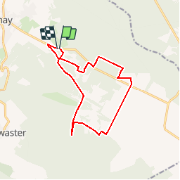
Luik - 20190105 - Jalhay - Schaapherder - Statte

misph
Gebruiker

Lengte
12,2 km

Max. hoogte
562 m

Positief hoogteverschil
186 m
Km-Effort
14,7 km

Min. hoogte
416 m

Negatief hoogteverschil
192 m
Boucle
Ja
Datum van aanmaak :
2019-01-15 20:34:10.338
Laatste wijziging :
2019-01-15 20:34:10.338
3h11
Moeilijkheid : Medium

Gratisgps-wandelapplicatie
 SityTrail
IGN / Geografische instituten
SityTrail Plus
De wereld gaat voor u open
Over ons
Tocht Stappen van 12,2 km beschikbaar op Wallonië, Luik, Jalhay. Deze tocht wordt voorgesteld door misph.
Plaatsbepaling
Land:
Belgium
Regio :
Wallonië
Departement/Provincie :
Luik
Gemeente :
Jalhay
Locatie:
Jalhay
Vertrek:(Dec)
Vertrek:(UTM)
712087 ; 5604074 (31U) N.
Opmerkingen