Tocht Stappen Pujaudran - De Tellère près de la forêt de Bouconne à Lias - Photo

De Tellère près de la forêt de Bouconne à Lias

 tracegps
tracegps

Gebruiker

© OpenStreetMap contributors
Lengte
Lengte
15,3 km
Max. hoogte
Max. hoogte
306 m
Positief hoogteverschil
323 m
Km-Effort
Km-Effort  
19,6 km
Min. hoogte
Min. hoogte
208 m
Negatief hoogteverschil
325 m
Boucle
Boucle
Ja
Datum van aanmaak :
2014-12-10 00:00:00.0
Laatste wijziging :
2014-12-10 00:00:00.0

(0 Bericht)

Stappen
Stappen
4h15
Moeilijkheid : Medium

Scan deze QR-code om de tocht te openen in de SityTrail-applicatie

Gratisgps-wandelapplicatie

Logo SityTrail SityTrail

IGN / Geografische instituten

SityTrail uit de App Store downloaden SityTrail uit Google Play downloaden

Logo SityTrail SityTrail World

De wereld gaat voor u open

SityTrail uit de App Store downloaden SityTrail uit Google Play downloaden SityTrail op Huawei AppGallery downloaden

Over ons

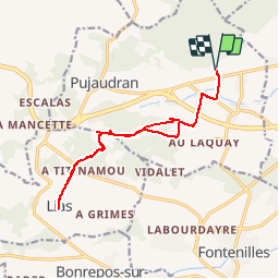
Tocht Stappen van 15,3 km beschikbaar op Occitanië, Gers, Pujaudran. Deze tocht wordt voorgesteld door tracegps.

Beschrijving

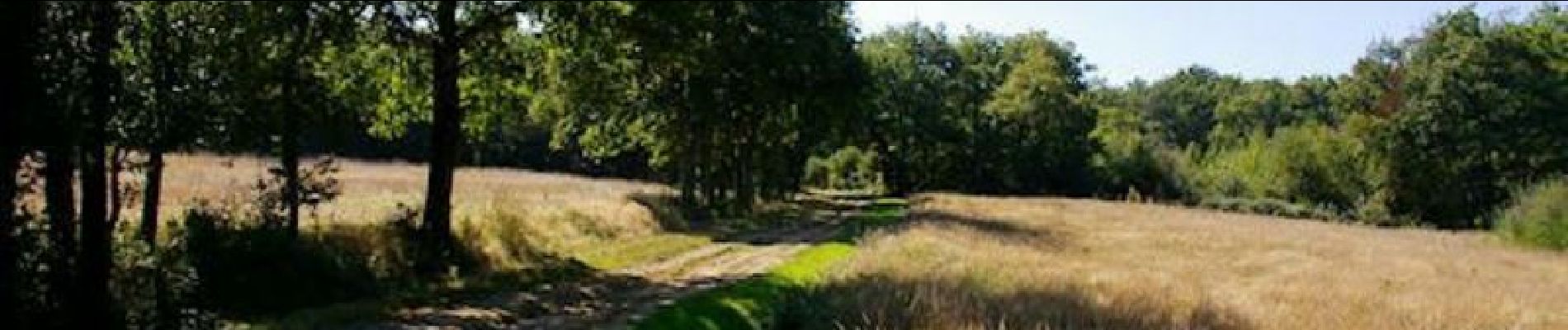
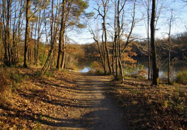
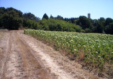
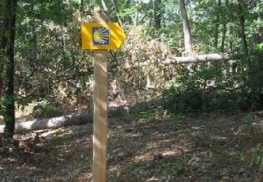
Un randonnée depuis Tellere au bord de la forêt de Bouconne vers Lias sur l'ancien ©GR86 (Aller et Retour)

Hoogteprofiel

Foto's

Plaatsbepaling

Land:
France
Regio :
Occitanië
Departement/Provincie :
Gers
Gemeente :
Pujaudran
Locatie:
Unknown
Vertrek:(Dec)
Vertrek:(UTM)
353521 ; 4828438 (31T) N.

Wandeltochten in de omgeving

Tocht Stappen Pibrac - Un tour en forêt de Bouconne - Photo
Stappen
tracegps

Stappen

Medium
(2)
Pibrac, Occitanië, Haute-Garonne, France
11,8 km | 13 km-effort
3h 0min
Ja
Tocht Te voet Pujaudran - Circuit de la Forêt de Lartus - Photo
Te voet
GUIDE+

Te voet

Gemakkelijk
Pujaudran, Occitanië, Gers, France
9,7 km | 12,4 km-effort
2h 49min
Ja
Tocht Lopen Pujaudran - Trois étoiles à Pujaudran - Photo
Lopen
tracegps

Lopen

Moeilijk
Pujaudran, Occitanië, Gers, France
18,9 km | 23 km-effort
2h 0min
Ja
Tocht Stappen Pujaudran - Trois étoiles à Pujaudran - Photo
Stappen
tracegps

Stappen

Moeilijk
Pujaudran, Occitanië, Gers, France
18,9 km | 23 km-effort
3h 49min
Ja
Tocht Stappen Lasserre-Pradère - LASSERE-PRADERE rando nocturne  - Photo
Stappen
chrisgps

Stappen

Medium
Lasserre-Pradère, Occitanië, Haute-Garonne, France
8 km | 9,6 km-effort
2h 11min
Ja
Tocht Lopen Pujaudran - Entre Bouconne et Pujaudran - Photo
Lopen
tracegps

Lopen

Moeilijk
Pujaudran, Occitanië, Gers, France
12,8 km | 16 km-effort
1h 15min
Ja
Tocht Stappen Pujaudran - Entre Bouconne et Pujaudran - Photo
Stappen
tracegps

Stappen

Moeilijk
Pujaudran, Occitanië, Gers, France
12,8 km | 16 km-effort
3h 30min
Ja
Tocht Lopen Fontenilles - Fontenilles à Lias - Photo
Lopen
tracegps

Lopen

Moeilijk
Fontenilles, Occitanië, Haute-Garonne, France
13,7 km | 16,4 km-effort
1h 19min
Ja
Tocht Mountainbike Fontenilles - Fontenilles à Lias - Photo
Mountainbike
tracegps

Mountainbike

Medium
Fontenilles, Occitanië, Haute-Garonne, France
13,7 km | 16,4 km-effort
1h 0min
Ja


Sluiten
Mijn abonnementen