


Zevtt - Chauray en VTT

kipoura
Gebruiker

Lengte
49 km

Max. hoogte
122 m

Positief hoogteverschil
568 m
Km-Effort
57 km

Min. hoogte
28 m

Negatief hoogteverschil
564 m
Boucle
Neen
Datum van aanmaak :
2019-05-03 17:11:20.472
Laatste wijziging :
2019-05-03 17:11:20.63
2h20
Moeilijkheid : Gemakkelijk

Gratisgps-wandelapplicatie
 SityTrail
IGN / Geografische instituten
SityTrail Plus
De wereld gaat voor u open
Over ons
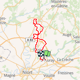
Tocht Mountainbike van 49 km beschikbaar op Nieuw-Aquitanië, Deux-Sèvres, Chauray. Deze tocht wordt voorgesteld door kipoura.
Beschrijving
A Chauray il n'y a pas que des Mutuelle ..... http://zevtt.free.fr
Plaatsbepaling
Land:
France
Regio :
Nieuw-Aquitanië
Departement/Provincie :
Deux-Sèvres
Gemeente :
Chauray
Locatie:
Unknown
Vertrek:(Dec)
Vertrek:(UTM)
700390 ; 5137270 (30T) N.
Opmerkingen