


Zevtt - La Créche en VTT

kipoura
Gebruiker

Lengte
38 km

Max. hoogte
137 m

Positief hoogteverschil
527 m
Km-Effort
45 km

Min. hoogte
40 m

Negatief hoogteverschil
532 m
Boucle
Neen
Datum van aanmaak :
2019-05-03 17:11:19.861
Laatste wijziging :
2019-05-03 17:11:19.956
2h00
Moeilijkheid : Gemakkelijk

Gratisgps-wandelapplicatie
 SityTrail
IGN / Geografische instituten
SityTrail Plus
De wereld gaat voor u open
Over ons
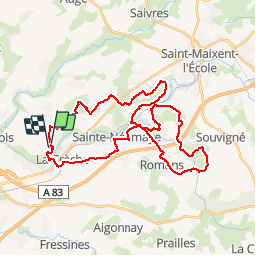
Tocht Mountainbike van 38 km beschikbaar op Nieuw-Aquitanië, Deux-Sèvres, La Crèche. Deze tocht wordt voorgesteld door kipoura.
Beschrijving
Parcours roulant pour faire du fond .... http://zevtt.free.fr
Plaatsbepaling
Land:
France
Regio :
Nieuw-Aquitanië
Departement/Provincie :
Deux-Sèvres
Gemeente :
La Crèche
Locatie:
Unknown
Vertrek:(Dec)
Vertrek:(UTM)
707333 ; 5138706 (30T) N.
Opmerkingen