


Népal 2

jpcccb
Gebruiker
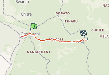

Lengte
13,2 km

Max. hoogte
3203 m

Positief hoogteverschil
946 m
Km-Effort
26 km

Min. hoogte
2524 m

Negatief hoogteverschil
1120 m
Boucle
Neen
Datum van aanmaak :
2019-05-07 01:24:13.755
Laatste wijziging :
2019-05-07 01:24:13.755
--
Moeilijkheid : Onbekend

Gratisgps-wandelapplicatie
 SityTrail
IGN / Geografische instituten
SityTrail Plus
De wereld gaat voor u open
Over ons
Tocht Stappen van 13,2 km beschikbaar op Onbekend, म्याग्दी, Ghara. Deze tocht wordt voorgesteld door jpcccb.
Plaatsbepaling
Land:
Nepal
Regio :
Onbekend
Departement/Provincie :
म्याग्दी
Gemeente :
Ghara
Locatie:
Unknown
Vertrek:(Dec)
Vertrek:(UTM)
764516 ; 3144868 (44R) N.
Opmerkingen