Tocht Mountainbike Boivre-la-Vallée - Zevtt - Lavausseau 2012 - Photo
 kipoura
kipoura

Gebruiker

© OpenStreetMap contributors
Lengte
Lengte
48 km
Max. hoogte
Max. hoogte
183 m
Positief hoogteverschil
448 m
Km-Effort
Km-Effort  
53 km
Min. hoogte
Min. hoogte
109 m
Negatief hoogteverschil
451 m
Boucle
Boucle
Ja
Datum van aanmaak :
2019-05-03 17:10:38.477
Laatste wijziging :
2019-05-03 17:10:38.554

(0 Bericht)

Mountainbike
Mountainbike
2h30
Moeilijkheid : Medium

Scan deze QR-code om de tocht te openen in de SityTrail-applicatie

Gratisgps-wandelapplicatie

Logo SityTrail SityTrail

IGN / Geografische instituten

SityTrail uit de App Store downloaden SityTrail uit Google Play downloaden

Logo SityTrail SityTrail Plus

De wereld gaat voor u open

SityTrail uit de App Store downloaden SityTrail uit Google Play downloaden SityTrail op Huawei AppGallery downloaden

Over ons

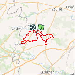
Tocht Mountainbike van 48 km beschikbaar op Nieuw-Aquitanië, Vienne, Boivre-la-Vallée. Deze tocht wordt voorgesteld door kipoura.

Beschrijving

Une trace GPS reprenant le parcours de la randonnée VTT de Lavausseau 2012. Un circuit typé roulant avec de beau passages ludiques et  quelques belles grimpettes ..... http://zevtt.free.fr

Hoogteprofiel

Plaatsbepaling

Land:
France
Regio :
Nieuw-Aquitanië
Departement/Provincie :
Vienne
Gemeente :
Boivre-la-Vallée
Locatie:
Unknown
Vertrek:(Dec)
Vertrek:(UTM)
275714 ; 5160288 (31T) N.


Sluiten
Mijn abonnementen