![](/images/other/stat-length.png)
![Tocht Paard Malansac - malansacRochefortenTerre2012-06-17 - Photo](https://media.geolcdn.com/t/1900/400/ext.pjpeg?maxdim=2&url=https%3A%2F%2Fstatic1.geolcdn.com%2Fsiteimages%2Fupload%2Ffiles%2F1524743154cheval.jpg)
malansacRochefortenTerre2012-06-17
Brigit
Gebruiker
![Lengte](/images/other/stat-length.png)
Lengte
18,8 km
![Max. hoogte](https://static1.geolcdn.com/siteimages/upload/files/1508320355ic_sort_altitude_max_24dp.png)
Max. hoogte
88 m
![Positief hoogteverschil](https://static1.geolcdn.com/siteimages/upload/files/1508320355ic_sort_den_pos_24dp.png)
Positief hoogteverschil
241 m
![Km-Effort](/images/other/stat-length.png)
Km-Effort
22 km
![Min. hoogte](https://static1.geolcdn.com/siteimages/upload/files/1508320355ic_sort_altitude_min_24dp.png)
Min. hoogte
26 m
![Negatief hoogteverschil](https://static1.geolcdn.com/siteimages/upload/files/1508320355ic_sort_den_neg_24dp.png)
Negatief hoogteverschil
240 m
![Boucle](https://static1.geolcdn.com/siteimages/upload/files/16400158638029165_repeat_loop_refresh_sync_direction_icon.png)
Boucle
Ja
Datum van aanmaak :
2014-12-10 00:00:00.0
Laatste wijziging :
2014-12-10 00:00:00.0
![Paard](https://static1.geolcdn.com/sitytour/trail-icons/300.png)
2h41
Moeilijkheid : Medium
![Scan deze QR-code om de tocht te openen in de SityTrail-applicatie](https://capi.geolives.com/qq0zvz2zws4bq2lad0pu/sitytour/trails/134237/qr.png?size=200)
Gratisgps-wandelapplicatie
Over ons
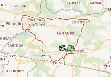
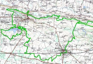
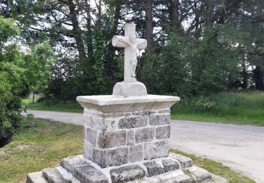
Tocht Paard van 18,8 km beschikbaar op Bretagne, Morbihan, Malansac. Deze tocht wordt voorgesteld door Brigit.
Beschrijving
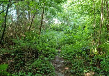
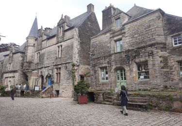
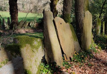
Super randonnée dans les bois et la lande.Vue magnifique au dessus de Rochefort en Terre ...
(Dommage que les premiers et derniers Kilomètres soient sur la route)
Plaatsbepaling
Land:
France
Regio :
Bretagne
Departement/Provincie :
Morbihan
Gemeente :
Malansac
Locatie:
Unknown
Vertrek:(Dec)
Vertrek:(UTM)
552216 ; 5280326 (30T) N.
Opmerkingen
Wandeltochten in de omgeving
![Tocht Mountainbike Malansac - Rando VTT Malansac 2010 - Photo](https://media.geolcdn.com/t/375/260/ext.jpg?maxdim=2&url=https%3A%2F%2Fservices.sitytrail.com%2FGeolivesWS%2FDownloadMedia.ashx%3FTrailID%3D105587%26Media%3D9358_1.jpg)
![Mountainbike Mountainbike](https://static1.geolcdn.com/sitytour/trail-icons/202.png)
Rando VTT Malansac 2010
Mountainbike
Moeilijk
(1)
Malansac,
Bretagne,
Morbihan,
France
![](/images/other/stat-length.png)
34 km | 40 km-effort
3h 0min
![](https://static1.geolcdn.com/siteimages/upload/files/16400158638029165_repeat_loop_refresh_sync_direction_icon.png)
Ja
![Tocht Te voet Rochefort-en-Terre - Circuit de Rochefort - Photo](https://media.geolcdn.com/t/375/260/ext.jpg?maxdim=2&url=https%3A%2F%2Fmedia.geolcdn.com%2Ff%2Fc9797295-9c5c-4d94-a3e1-5b520a62ca6b.jpeg)
![Te voet Te voet](https://static1.geolcdn.com/sitytour/trail-icons/100.png)
Circuit de Rochefort
Te voet
Gemakkelijk
Rochefort-en-Terre,
Bretagne,
Morbihan,
France
![](/images/other/stat-length.png)
7,5 km | 9,1 km-effort
2h 3min
![](https://static1.geolcdn.com/siteimages/upload/files/16400158638029165_repeat_loop_refresh_sync_direction_icon.png)
Ja
![Tocht Stappen Rochefort-en-Terre - Rochefort en terre - Photo](https://media.geolcdn.com/t/375/260/ext.jpg?maxdim=2&url=https%3A%2F%2Fstatic1.geolcdn.com%2Fsiteimages%2Fupload%2Ffiles%2F1553511878bg_sport_marche.png)
![Stappen Stappen](https://static1.geolcdn.com/sitytour/trail-icons/101.png)
Rochefort en terre
Stappen
Gemakkelijk
(1)
Rochefort-en-Terre,
Bretagne,
Morbihan,
France
![](/images/other/stat-length.png)
3,3 km | 4,1 km-effort
1h 25min
![](https://static1.geolcdn.com/siteimages/upload/files/16400158638029165_repeat_loop_refresh_sync_direction_icon.png)
Ja
![Tocht Stappen Rochefort-en-Terre - Rochefort en terre - Photo](https://media.geolcdn.com/t/375/260/ext.jpg?maxdim=2&url=https%3A%2F%2Fstatic1.geolcdn.com%2Fsiteimages%2Fupload%2Ffiles%2F1553511878bg_sport_marche.png)
![Stappen Stappen](https://static1.geolcdn.com/sitytour/trail-icons/101.png)
Rochefort en terre
Stappen
Gemakkelijk
(1)
Rochefort-en-Terre,
Bretagne,
Morbihan,
France
![](/images/other/stat-length.png)
14,2 km | 17,7 km-effort
3h 46min
![](https://static1.geolcdn.com/siteimages/upload/files/16400158638029165_repeat_loop_refresh_sync_direction_icon.png)
Ja
![Tocht Stappen Limerzel - PR_56_Limerzel_AA_01_Circuit1b_Vallee-Du-Trevelo_20231215 - Photo](https://media.geolcdn.com/t/375/260/ext.jpg?maxdim=2&url=https%3A%2F%2Fmedia.geolcdn.com%2Ff%2Fb434d388-f2cf-4273-a9c9-f910c9f7a88a.jpg)
![Stappen Stappen](https://static1.geolcdn.com/sitytour/trail-icons/101.png)
PR_56_Limerzel_AA_01_Circuit1b_Vallee-Du-Trevelo_20231215
Stappen
Moeilijk
Limerzel,
Bretagne,
Morbihan,
France
![](/images/other/stat-length.png)
11,9 km | 14 km-effort
3h 10min
![](https://static1.geolcdn.com/siteimages/upload/files/16400158638029165_repeat_loop_refresh_sync_direction_icon.png)
Ja
![Tocht Stappen Limerzel - Limerzel Sentier du Sillon - Photo](https://media.geolcdn.com/t/375/260/ext.jpg?maxdim=2&url=https%3A%2F%2Fmedia.geolcdn.com%2Ff%2Fe5c40b33-a7bf-4c14-985e-7b1dc60ed7f4.jpg)
![Stappen Stappen](https://static1.geolcdn.com/sitytour/trail-icons/101.png)
Limerzel Sentier du Sillon
Stappen
Medium
Limerzel,
Bretagne,
Morbihan,
France
![](/images/other/stat-length.png)
10,1 km | 12,6 km-effort
2h 58min
![](https://static1.geolcdn.com/siteimages/upload/files/16400158638029165_repeat_loop_refresh_sync_direction_icon.png)
Ja
![Tocht Stappen Limerzel - GRP_Lanvaux_AI_09_Limerzel_Berric_20210528 - Photo](https://media.geolcdn.com/t/375/260/ext.jpg?maxdim=2&url=https%3A%2F%2Fmedia.geolcdn.com%2Ff%2Fc931dd36-7661-451d-be62-fb02e50c34f3.jpg)
![Stappen Stappen](https://static1.geolcdn.com/sitytour/trail-icons/101.png)
GRP_Lanvaux_AI_09_Limerzel_Berric_20210528
Stappen
Gemakkelijk
Limerzel,
Bretagne,
Morbihan,
France
![](/images/other/stat-length.png)
21 km | 25 km-effort
5h 18min
![](https://static1.geolcdn.com/siteimages/upload/files/16400158638029165_repeat_loop_refresh_sync_direction_icon.png)
Neen
![Tocht Stappen Pluherlin - GRP_Lanvaux_AH_08_Rochefort-Terre_Limerzel_20210515 - Photo](https://media.geolcdn.com/t/375/260/ext.jpg?maxdim=2&url=https%3A%2F%2Fmedia.geolcdn.com%2Ff%2Ff476e017-5a16-48c2-9ee0-f5d72d4f165e.jpg)
![Stappen Stappen](https://static1.geolcdn.com/sitytour/trail-icons/101.png)
GRP_Lanvaux_AH_08_Rochefort-Terre_Limerzel_20210515
Stappen
Gemakkelijk
Pluherlin,
Bretagne,
Morbihan,
France
![](/images/other/stat-length.png)
13,5 km | 16,3 km-effort
3h 28min
![](https://static1.geolcdn.com/siteimages/upload/files/16400158638029165_repeat_loop_refresh_sync_direction_icon.png)
Neen
![Tocht Stappen Pluherlin - Rochefort en terre - Photo](https://media.geolcdn.com/t/375/260/ext.jpg?maxdim=2&url=https%3A%2F%2Fmedia.geolcdn.com%2Ff%2Ff7e5a291-bcaa-4868-be57-1c1c8da9528f.jpg)
![Stappen Stappen](https://static1.geolcdn.com/sitytour/trail-icons/101.png)
Rochefort en terre
Stappen
Medium
Pluherlin,
Bretagne,
Morbihan,
France
![](/images/other/stat-length.png)
17,5 km | 21 km-effort
4h 1min
![](https://static1.geolcdn.com/siteimages/upload/files/16400158638029165_repeat_loop_refresh_sync_direction_icon.png)
Ja