Tocht Stappen Fontainebleau - GLM-120926.1 - GdMaître-StLouis  - Photo

GLM-120926.1 - GdMaître-StLouis

 randodan
randodan

Gebruiker

© OpenStreetMap contributors
Lengte
Lengte
9,8 km
Max. hoogte
Max. hoogte
143 m
Positief hoogteverschil
150 m
Km-Effort
Km-Effort  
11,8 km
Min. hoogte
Min. hoogte
89 m
Negatief hoogteverschil
150 m
Boucle
Boucle
Ja
Datum van aanmaak :
2014-12-10 00:00:00.0
Laatste wijziging :
2014-12-10 00:00:00.0

(0 Bericht)

Stappen
Stappen
3h32
Moeilijkheid : Heel gemakkelijk

Scan deze QR-code om de tocht te openen in de SityTrail-applicatie

Gratisgps-wandelapplicatie

Logo SityTrail SityTrail

IGN / Geografische instituten

SityTrail uit de App Store downloaden SityTrail uit Google Play downloaden

Logo SityTrail SityTrail Plus

De wereld gaat voor u open

SityTrail uit de App Store downloaden SityTrail uit Google Play downloaden SityTrail op Huawei AppGallery downloaden

Over ons

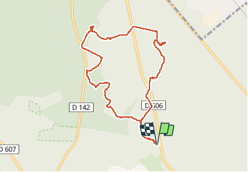
Tocht Stappen van 9,8 km beschikbaar op Île-de-France, Seine-et-Marne, Fontainebleau. Deze tocht wordt voorgesteld door randodan.

Beschrijving

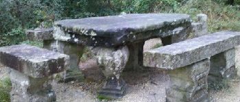
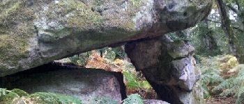
Les Gais Lurons du Mercredi . 26 septembre 2012 matin . Départ parking Cabaret Masson .
Denecourt 12, Table Gd Maître, Petit Mont, Butte Saint-Louis  .
6 participants .
Pique-nique Cabaret Masson mais à 3 seulement .
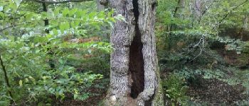
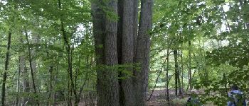
Hoogteprofiel

Foto's

POI's

POI Fontainebleau - Arbre remarquable 1 - Photo
randodan
FONTAINEBLEAU 
POI Fontainebleau - Table Gd Maître - Photo
randodan
FONTAINEBLEAU 
POI Fontainebleau - Arbre remarquable 2 - Photo
randodan
FONTAINEBLEAU 
POI Fontainebleau - Rocher 'K' - Photo
randodan
FONTAINEBLEAU 

Plaatsbepaling

Land:
France
Regio :
Île-de-France
Departement/Provincie :
Seine-et-Marne
Gemeente :
Fontainebleau
Locatie:
Unknown
Vertrek:(Dec)
Vertrek:(UTM)
477008 ; 5365366 (31U) N.


Sluiten
Mijn abonnementen