


DE PORT EN PORT A TRAVERS BOIS

NUITEVEN
Gebruiker

Lengte
27 km

Max. hoogte
152 m

Positief hoogteverschil
324 m
Km-Effort
31 km

Min. hoogte
42 m

Negatief hoogteverschil
343 m
Boucle
Neen
Datum van aanmaak :
2014-12-10 00:00:00.0
Laatste wijziging :
2014-12-10 00:00:00.0
6h47
Moeilijkheid : Gemakkelijk

Gratisgps-wandelapplicatie
 SityTrail
IGN / Geografische instituten
SityTrail Plus
De wereld gaat voor u open
Over ons
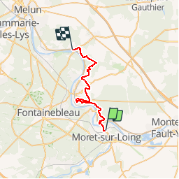
Tocht Stappen van 27 km beschikbaar op Île-de-France, Seine-et-Marne, Saint-Mammès. Deze tocht wordt voorgesteld door NUITEVEN.
Plaatsbepaling
Land:
France
Regio :
Île-de-France
Departement/Provincie :
Seine-et-Marne
Gemeente :
Saint-Mammès
Locatie:
Unknown
Vertrek:(Dec)
Vertrek:(UTM)
486384 ; 5358790 (31U) N.
Opmerkingen