


pointe du hoc-arromanches

albers
Gebruiker

Lengte
37 km

Max. hoogte
76 m

Positief hoogteverschil
524 m
Km-Effort
44 km

Min. hoogte
0 m

Negatief hoogteverschil
537 m
Boucle
Neen
Datum van aanmaak :
2014-12-10 00:00:00.0
Laatste wijziging :
2014-12-10 00:00:00.0
9h24
Moeilijkheid : Moeilijk

Gratisgps-wandelapplicatie
 SityTrail
IGN / Geografische instituten
SityTrail Plus
De wereld gaat voor u open
Over ons
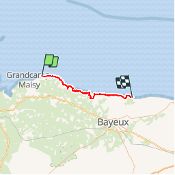
Tocht Stappen van 37 km beschikbaar op Normandië, Calvados, Cricqueville-en-Bessin. Deze tocht wordt voorgesteld door albers.
Plaatsbepaling
Land:
France
Regio :
Normandië
Departement/Provincie :
Calvados
Gemeente :
Cricqueville-en-Bessin
Locatie:
Unknown
Vertrek:(Dec)
Vertrek:(UTM)
645898 ; 5473522 (30U) N.
Opmerkingen