


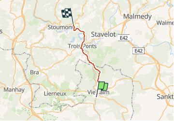
Vielsalm-La gleize

albert318
Gebruiker

Lengte
21 km

Max. hoogte
454 m

Positief hoogteverschil
557 m
Km-Effort
29 km

Min. hoogte
213 m

Negatief hoogteverschil
607 m
Boucle
Neen
Datum van aanmaak :
2014-12-10 00:00:00.0
Laatste wijziging :
2014-12-10 00:00:00.0
6h03
Moeilijkheid : Medium

Gratisgps-wandelapplicatie
 SityTrail
IGN / Geografische instituten
SityTrail Plus
De wereld gaat voor u open
Over ons
Tocht Stappen van 21 km beschikbaar op Wallonië, Luxemburg, Vielsalm. Deze tocht wordt voorgesteld door albert318.
Beschrijving
De Vielsalm à La Gleize par le chemin des croix
Plaatsbepaling
Land:
Belgium
Regio :
Wallonië
Departement/Provincie :
Luxemburg
Gemeente :
Vielsalm
Locatie:
Vielsalm
Vertrek:(Dec)
Vertrek:(UTM)
707350 ; 5573832 (31U) N.
Opmerkingen