


Gouvix

Jeff_314
Gebruiker
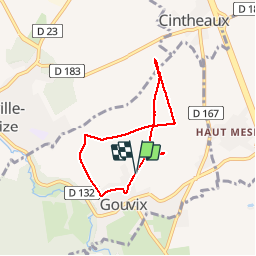

Lengte
5,7 km

Max. hoogte
118 m

Positief hoogteverschil
47 m
Km-Effort
6,3 km

Min. hoogte
89 m

Negatief hoogteverschil
47 m
Boucle
Ja
Datum van aanmaak :
2014-12-10 00:00:00.0
Laatste wijziging :
2014-12-10 00:00:00.0
1h50
Moeilijkheid : Gemakkelijk

Gratisgps-wandelapplicatie
 SityTrail
IGN / Geografische instituten
SityTrail Plus
De wereld gaat voor u open
Over ons
Tocht Stappen van 5,7 km beschikbaar op Normandië, Calvados, Gouvix. Deze tocht wordt voorgesteld door Jeff_314.
Beschrijving
les fours, l'ancienne ligne de chemin de fer
Plaatsbepaling
Land:
France
Regio :
Normandië
Departement/Provincie :
Calvados
Gemeente :
Gouvix
Locatie:
Unknown
Vertrek:(Dec)
Vertrek:(UTM)
697229 ; 5435223 (30U) N.
Opmerkingen