


tour de la foret de Montgeon

Laurent53
Gebruiker

Lengte
10,7 km

Max. hoogte
93 m

Positief hoogteverschil
212 m
Km-Effort
13,5 km

Min. hoogte
21 m

Negatief hoogteverschil
211 m
Boucle
Ja
Datum van aanmaak :
2018-09-14 15:13:47.418
Laatste wijziging :
2018-09-14 15:15:39.183
2h54
Moeilijkheid : Gemakkelijk

Gratisgps-wandelapplicatie
 SityTrail
IGN / Geografische instituten
SityTrail Plus
De wereld gaat voor u open
Over ons
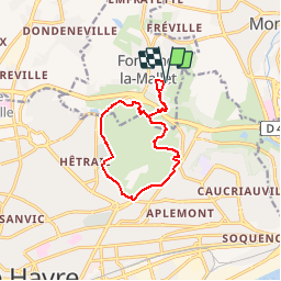
Tocht Stappen van 10,7 km beschikbaar op Normandië, Seine-Maritime, Fontaine-la-Mallet. Deze tocht wordt voorgesteld door Laurent53.
Plaatsbepaling
Land:
France
Regio :
Normandië
Departement/Provincie :
Seine-Maritime
Gemeente :
Fontaine-la-Mallet
Locatie:
Unknown
Vertrek:(Dec)
Vertrek:(UTM)
293923 ; 5490671 (31U) N.
Opmerkingen