


Balade au dessus de Latour de Carol

c.chehere
Gebruiker

Lengte
24 km

Max. hoogte
1638 m

Positief hoogteverschil
660 m
Km-Effort
32 km

Min. hoogte
1201 m

Negatief hoogteverschil
660 m
Boucle
Ja
Datum van aanmaak :
2018-10-04 07:53:00.403
Laatste wijziging :
2018-10-04 17:01:33.885
7h21
Moeilijkheid : Medium

Gratisgps-wandelapplicatie
 SityTrail
IGN / Geografische instituten
SityTrail Plus
De wereld gaat voor u open
Over ons
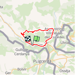
Tocht Stappen van 24 km beschikbaar op Occitanië, Pyrénées-Orientales, Enveitg. Deze tocht wordt voorgesteld door c.chehere.
Foto's


Plaatsbepaling
Land:
France
Regio :
Occitanië
Departement/Provincie :
Pyrénées-Orientales
Gemeente :
Enveitg
Locatie:
Unknown
Vertrek:(Dec)
Vertrek:(UTM)
409999 ; 4701331 (31T) N.
Opmerkingen