


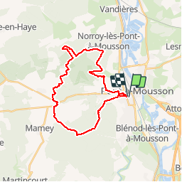
Bois-le-Prêtre - Puvenelle

PhilippeC54
Gebruiker

Lengte
26 km

Max. hoogte
389 m

Positief hoogteverschil
431 m
Km-Effort
32 km

Min. hoogte
178 m

Negatief hoogteverschil
429 m
Boucle
Ja
Datum van aanmaak :
2018-11-16 13:19:46.075
Laatste wijziging :
2018-11-16 17:06:46.912
2h52
Moeilijkheid : Heel gemakkelijk

Gratisgps-wandelapplicatie
 SityTrail
IGN / Geografische instituten
SityTrail Plus
De wereld gaat voor u open
Over ons
Tocht Mountainbike van 26 km beschikbaar op Grand Est, Meurthe-et-Moselle, Pont-à-Mousson. Deze tocht wordt voorgesteld door PhilippeC54.
Plaatsbepaling
Land:
France
Regio :
Grand Est
Departement/Provincie :
Meurthe-et-Moselle
Gemeente :
Pont-à-Mousson
Locatie:
Unknown
Vertrek:(Dec)
Vertrek:(UTM)
283575 ; 5420425 (32U) N.
Opmerkingen